BLOG: Severe storms bring baseball size hail to Central Texas

Editor’s Note: The video above shows the latest from the KXAN First Warning Weather team.
AUSTIN (KXAN) — Central Texas could see periods of strong to severe storms through the day Tuesday and into the overnight hours.
KXAN First Warning Weather forecast
There’s a slight risk for severe storms in many counties and some areas may see several inches of rain that could lead to flooding.
Large hail, damaging winds and isolated tornadoes will be possible within any well-developed thunderstorm.
Weather Resources
Check below for a live blog of the weather events throughout Central Texas:
Overnight
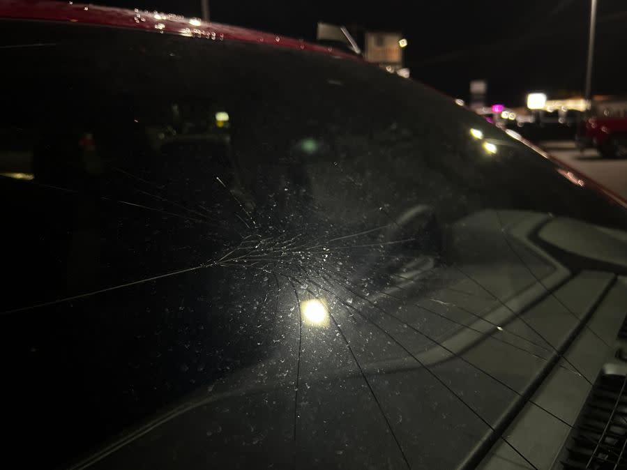
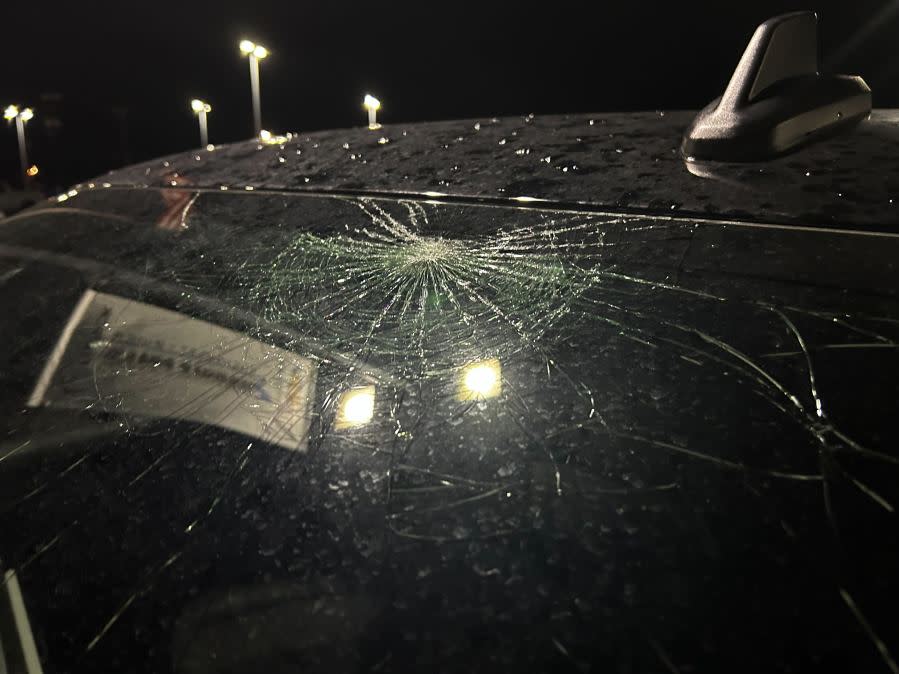
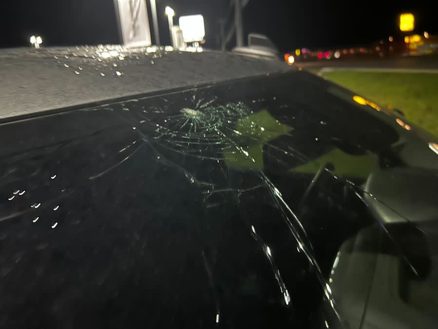
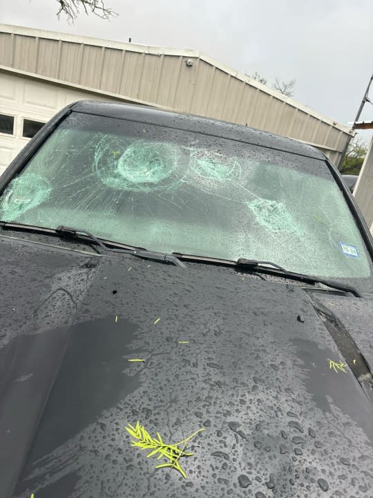
Vehicle damaged by hail in Marble Falls (KXAN photo/Dylan McKim) Vehicle damaged by hail in Marble Falls (KXAN photo/Dylan McKim) Vehicle damaged by hail in Marble Falls (KXAN photo/Dylan McKim) Vehicle damaged by hail in Marble Falls (KXAN photo/Dylan McKim) Vehicle damaged by hail in Marble Falls (KXAN photo/Dylan McKim) Vehicle damaged by hail in Marble Falls (KXAN photo/Dylan McKim)


8:45 p.m.
A viewer sent in video of hail coming down in Marble Falls
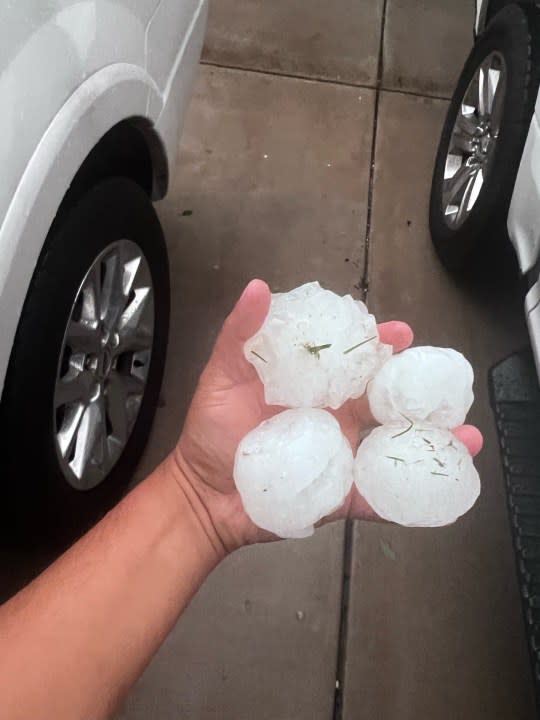
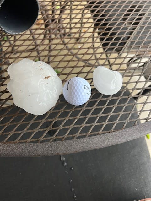
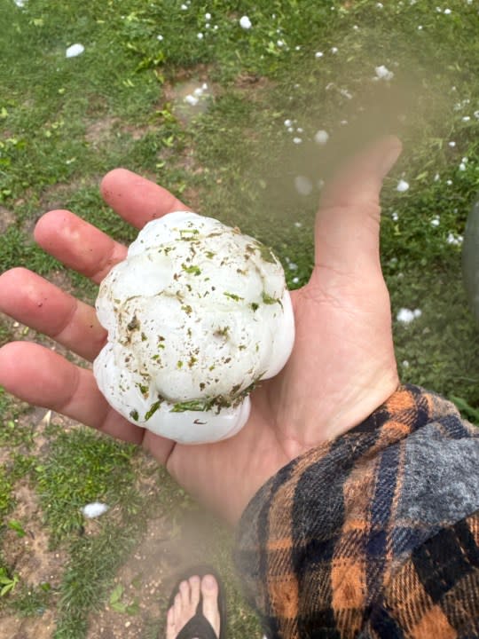
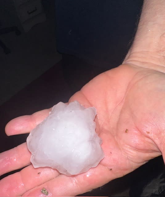
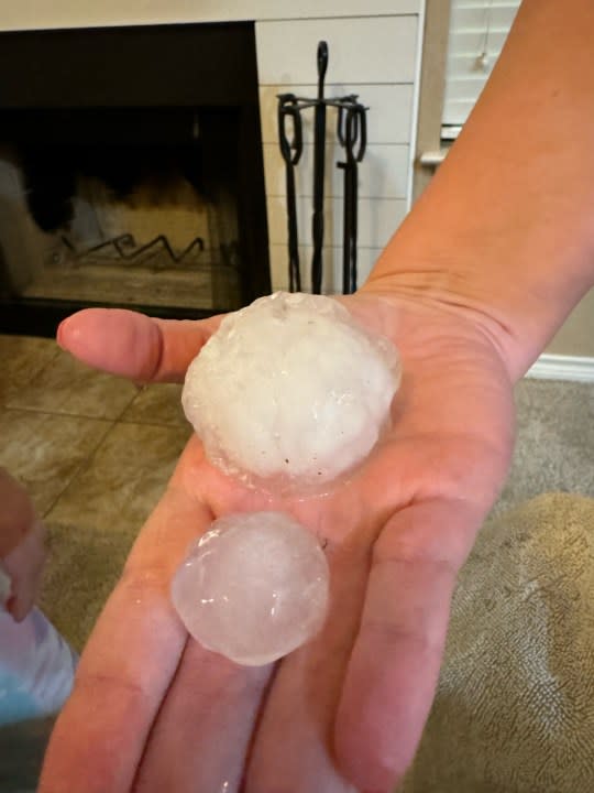
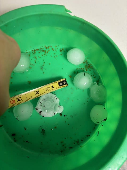
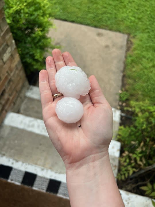
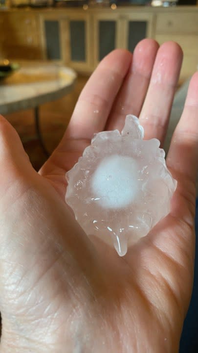
Baseball size hail was reported in Marble Falls. A few of our viewers sent in these photos.
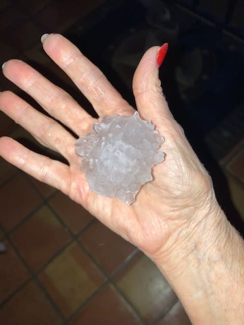
Hail and damage in Marble Falls | Courtesy Christopher Gonzales. Hail photo in Lake Victor | KXAN viewer photo Lampasas hail | Courtesy: Fox Family Baseball size hail in Marble Falls | KXAN viewer photo Hail in Marble Falls { KXAN viewer photo Hail in Marble Falls | KXAN viewer photo Lampasas hail damage | Courtesy: Fox Family Hail and damage in Marble Falls | Courtesy Christopher Gonzales. Hail photo in Horseshoe Bay Hail in Spicewood | Courtesy Kathy Bellamy


8:32 p.m.
The Austin Fire Department reported wires down in the 1500 block of East Anderson Lane and the 1200 block of Belmont Parkway, the agency said on social media.
According to AFD, reports indicated broken poles from wind damage. Additionally, “multiple weather related vehicle accidents and Fire Alarm activations” began since storms started this afternoon.
8:30 p.m.
Baseball size hail was coming down in Marble Falls this evening. A KXAN viewer sent us this video.
8:20 p.m.
The Austin Fire Department is responding to “multiple weather related calls,” which includes two structure fires. The first was reported at 12100 Metric and the other in the 6900 block of Langston Drive, the agency said on social media.
5:30 p.m.
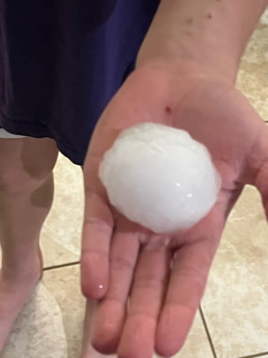
Hail was reported in areas, like north Austin, Pflugerville, Steiner Ranch and Shoal Creek
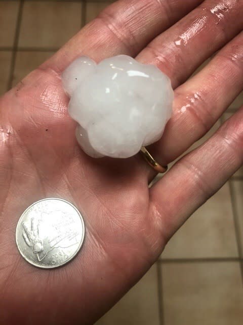
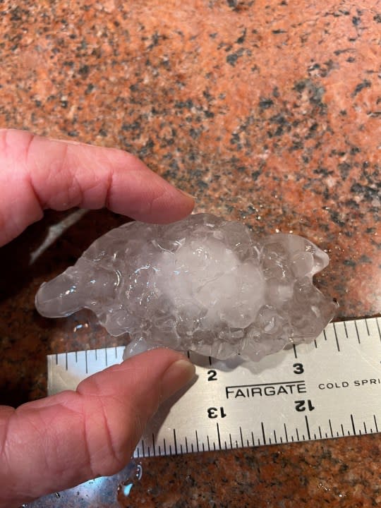
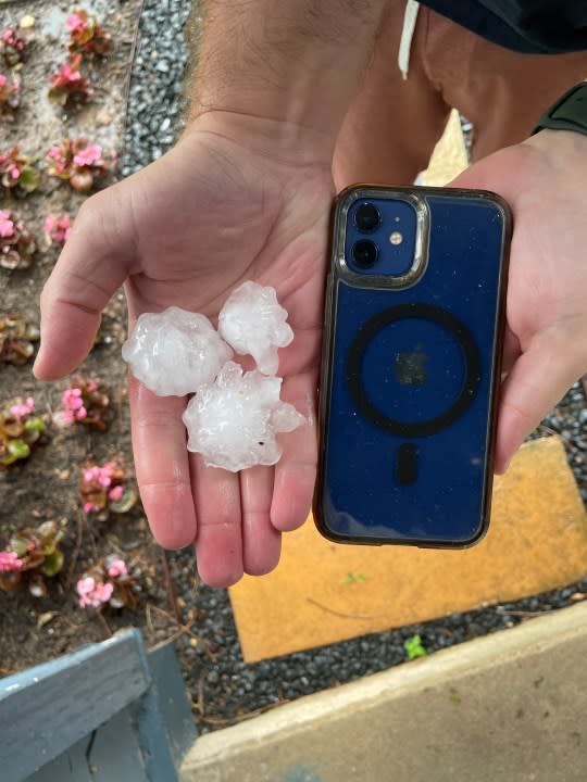
Viewers began sending in photos of hail, anywhere from penny size to tennis ball size.
Golf ball-sized hail at North MoPac Expressway and Spicewood Springs Road | KXAN viewer photo Hail photo from North MoPac Expressway and Spicewood Springs Road | Courtesy Tom W. Hail photo from severe storms in Shoal Creek | KXAN viewer photo Hail photo in north Austin | Courtesy Bruce Kravitz Hail photo | Courtesy Clara Hail photo in Northwest Hills | Courtesy Shirley Steele Hail photo in central Austin } Courtesy Mitch Heard Hail photo in Austin | Courtesy Lisa Clayton


5:05 p.m.
First Warning Weather is tracking a Tornado Warning reported in Mason County
4:20 p.m.
Severe Thunderstorm Warning in effect for Bee Cave and West Lake Hills
10:30 a.m.
Tornado Warning for Bertram, Liberty Hill and Fairland expires.
Severe Thunderstorm Warning continues for Bertram, Watson and Briggs until 10:45, according to the NWS.
10:22 a.m.
Burnet County Office of Emergency Management is not reporting damage so far. The office is staying in touch with the Bertram Police Chief about whether they hear damage reports.
Burnet CISD is not in school today. Classes resume tomorrow.
10 a.m.
National Weather Service issues Tornado Warning for Bertram, Liberty Hill and Fairland until 10:30 a.m.
9:52 a.m.
Severe Thunderstorm Warning issued for Marble Falls, Burnet and Meadowlakes until 10:45 a.m.
9:40 a.m.
Tornado Watch issued for parts of Texas until 5 p.m.

8:54 a.m.
The National Weather Service said hail around a half an inch in size was reported with the strong storms near and north of Austin.
Check back for updates.
For the latest news, weather, sports, and streaming video, head to KXAN Austin.

