Bitter cold descends over Chicago; wind chill advisory to remain in place until Wednesday
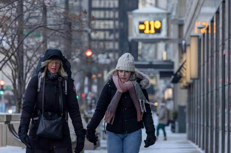
A wind chill advisory is expected to remain in place across the Chicago area through Wednesday as bitterly cold temperatures descend over the region, with wind chills Sunday morning reaching minus 40, the National Weather Service said.
. The coldest wind chill was recorded in Sterling, which reached 42 degrees below zero. At O’Hare International Airport, the city’s collection site, the wind chill hit minus 31, according to the weather service.
“It’s so bad this morning because the winds have remained elevated,” meteorologist Jake Petr said Sunday. “We still have gusts in the 30 to 35 mph range.”
By Wednesday afternoon, “some slight moderation in temperatures,” is expected, the weather service said. On Monday and Tuesday, the highs are predicted to remain in the single digits with freezing wind chills.
Mechanical problems due to the cold weather delayed and disrupted CTA Brown Line services throughout the day Sunday. As of Sunday night, no trains were running between Belmont and Kimball. Shuttle buses were providing connecting services between Kimball and Clark/Lake. Brown and Orange Line trains were sharing one route between Belmont and Midway.
The blast of arctic air follows a powerful storm system that blanketed the region Friday and Saturday. Over 13 inches of snow fell east of Rockford along the Illinois-Wisconsin state line. O’Hare recorded over 6 inches, while areas of the city closer to Lake Michigan received as little as 1 to 2 inches of snow, according to the weather service.
Wind chills Sunday morning were consistent across the northern and southern suburbs of the city but worse in the west near Aurora and Naperville, Petr said.
In the early morning hours blowing and drifting snow made for near-blizzard conditions in northern Illinois. Gusty winds and low visibility were worse in rural and open areas. Rapid ice formation is anticipated, and ice jams are possible in flood-prone areas, particularly along the Kankakee and Iroquois Rivers.
People are urged to stay inside as the dangerously low temperatures continue through midweek. Wind chills of minus 20 to 40 can cause frostbite on exposed skin in just 10 to 30 minutes, according to the weather service. Those who do venture outside are advised to layer and wear face masks and gloves.
“If you have to be outside, limit the time outdoors to as short of a window as possible,” Petr said. “If you have to be out even longer, certainly be bundled up as much as possible.”
The city announced that the lower level of Harold Washington Library would remain open 24/7 as a warming center for those seeking shelter in the extreme cold. Officials have added extended hours to drop-in centers for those experiencing homelessness.
Chicago Public Schools said that all events Monday in school buildings for Martin Luther King Jr. Day would be canceled in light of the weather. Class is not in session for the holiday, but officials will continue to monitor Tuesday’s forecast.
Mayor Brandon Johnson also announced Friday that his administration would delay the enforcement of the 60-day migrant shelter limit policy until at least Jan. 22 as temperatures plummet.
The first 43 days of this winter, from Dec. 1 to Jan. 12, had been the third warmest in Chicago on record, behind 1890 and 1878. Chicago had not had a day with a high temperature below freezing since Nov. 28, the weather service said.
