Baton Rouge severe weather: Multiple rounds of storms Thursday through Saturday
BATON ROUGE, La. (BRPROUD) – A rather active pattern continues over the Lower Mississippi Valley with multiple rounds of rain and storms likely as we close out the work week. A stationary boundary exists over the Gulf Coast that will eventually move northward as a warm front Thursday into Friday. This front will help spark a mesoscale convective systems (MCS), or large organized clusters of storms usually with a strong leading edge, into Thursday night.
A cold front will then approach from the west Friday night with the next round of storms. These storms will likely come as a MCS as well.
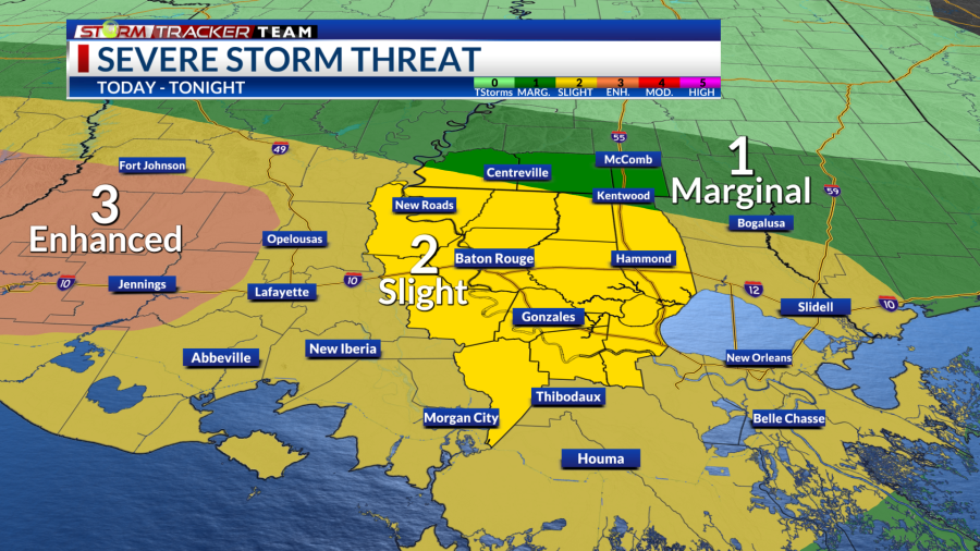
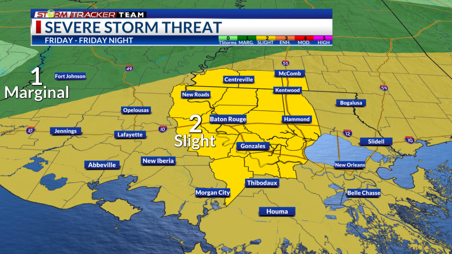
The Storm Prediction Center (SPC) has placed a slight risk (2/5) for severe weather over the viewing area for Thursday and Friday.
Threats
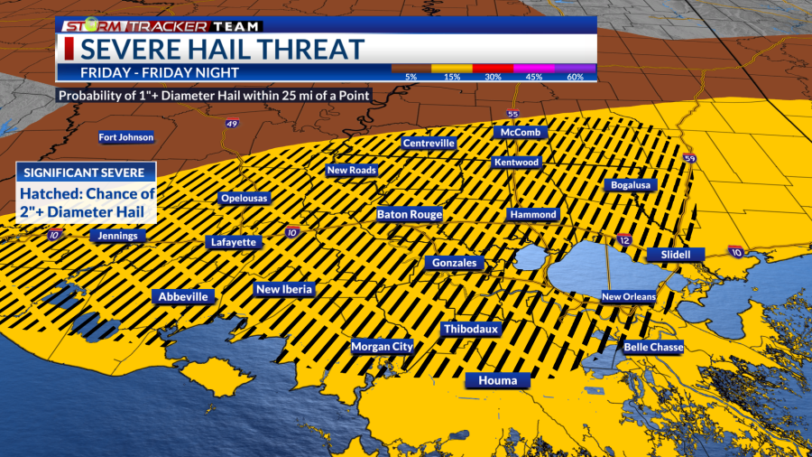
All modes of severe weather will be possible both days, including damaging wind gusts, large hail and tornadoes. Possible tornadoes may be embedded in the line of storms and could form very quickly. Friday may see see the potential for significant large hail (2″+ hail) in the hatched area below.
Severe Threats Friday Large Hail Threat
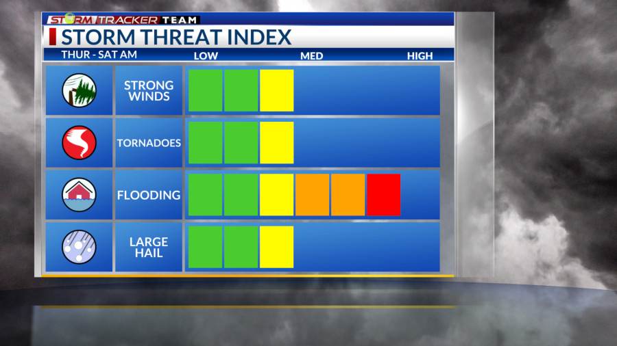
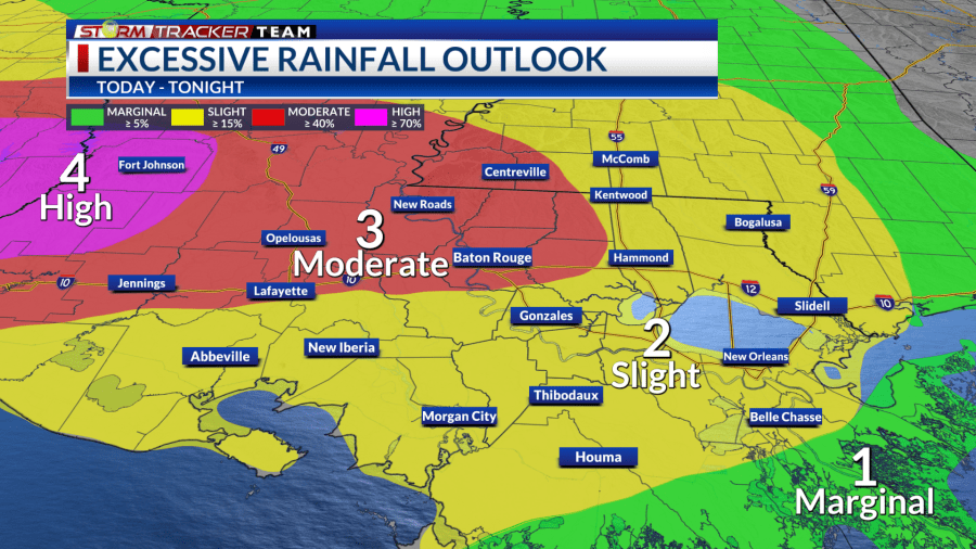
Flash flooding will also be a concern with any training segments bringing heavy downpours. The Weather Prediction Center (WPC) has placed portions of our area under a moderate risk (3/4) for flash flooding including Baton Rouge and a high risk (4/4) just off to the west over the TX/LA border.
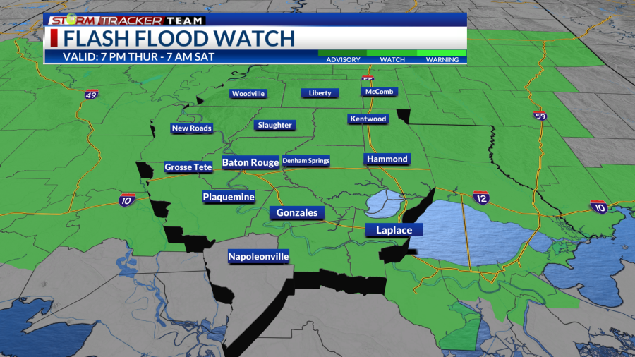
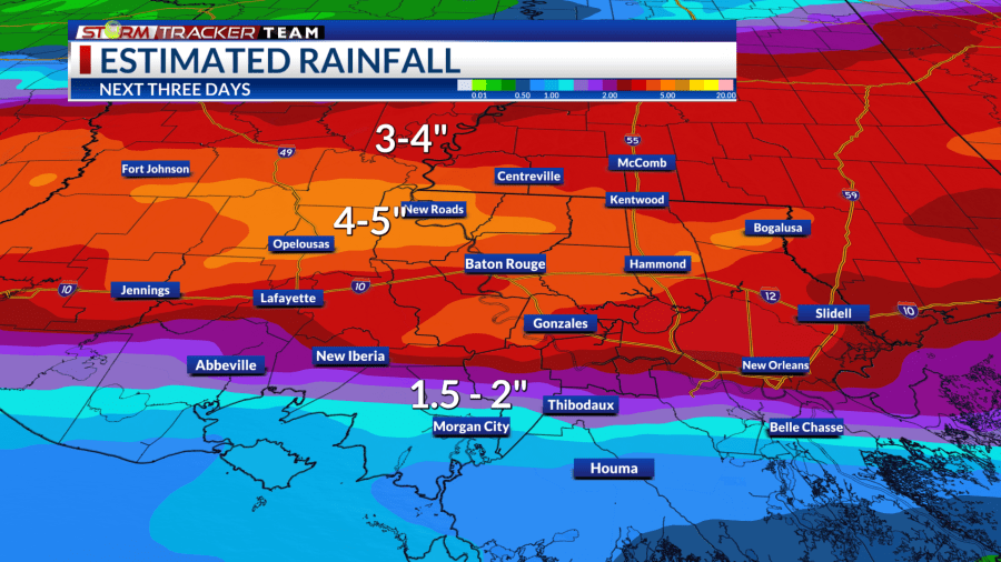
There will be a Flood Watch in effect from 7 p.m. Thursday through 7 a.m. Saturday. Around 2-5″ of rain with locally higher amounts up to 6″ will be possible. Areas near and north of the I-10/I-12 corridors will have the best chance of seeing the highest rainfall amounts.
Flash Flooding Risk Flood Watch Estimated Rainfall Amounts
Timing
The timing gets tricky with the forecast as uncertainty still exists with how these storm complexes evolve. Let’s break it down each day.
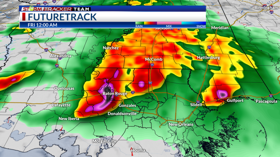
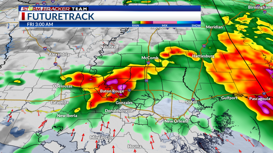
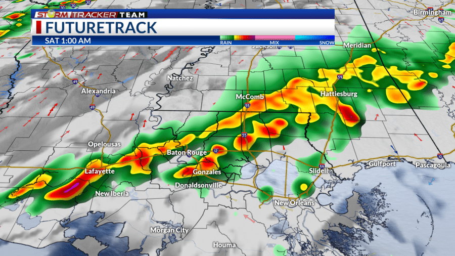
Thursday
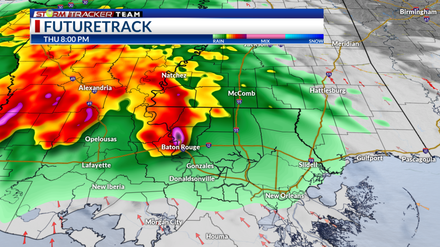
An upper-level disturbance will move into the area, sparking the first complex of storms beginning in the evening and moving across the region throughout the overnight hours. The window of main concern will lie between Thursday night and Friday morning.
With the uncertainty, these timings could change. Keep up to date with the forecast.
Late Evening Main Line Near Midnight Early AM
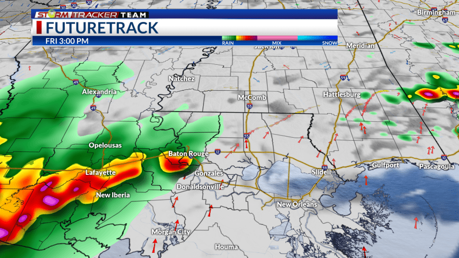
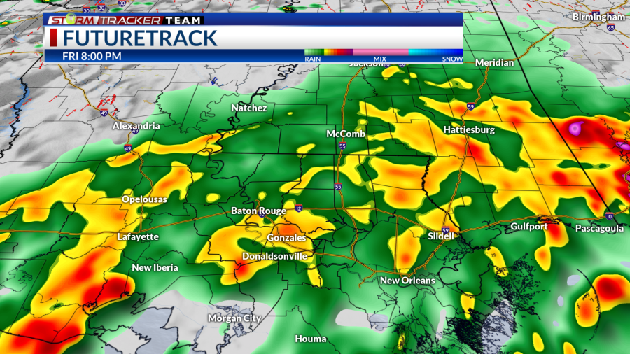
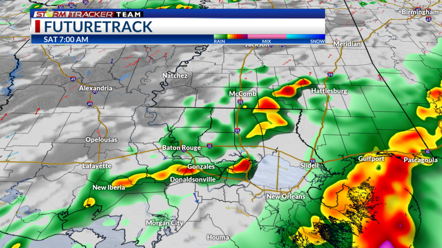
Friday
As the the first round exits to the east, we may see a lull in activity in the late morning/early afternoon hours. However, that first batch of storms will set up a boundary over the area to provide a focus for additional shower and storm development in the afternoon.
The next round will initiate over Texas and traverse toward our area during the day. How the complex evolves and how fast it moves will determine when it reaches us. The current thinking is for a window between Friday evening and Saturday morning.
Storm Development Along Afternoon Boundary Late Evening Overnight Saturday Morning
How to prepare
Be sure to have multiple ways to receive weather alerts and stay tuned to updated forecasts during the day. Make sure your phone is unmuted, charged and turned on for notifications. Turn off your do-not-disturb and take your phone off of silent mode so those alerts can reach you.
‘Ahead of the Storm’: What to know, how to get ready before tornadoes, strong storms, heavy rain
With an overnight aspect to this event, make sure any alerts or warnings can wake you up as well.
Have a plan and a safe place to go if a warning is issued for your location. Find a lower-level, interior room away from windows.
You can always check out the Interactive Radar here. For the latest forecast information, check out our weather page.
Remember that you can download our weather app in the App Store and on Google Play. Just search for “BRProud Weather.”
Follow and keep up to date with the Storm Tracker Team:
Chief Meteorologist Sam Parish – Twitter | Facebook | sparish@brproud.com
Meteorologist Brandon Lashbrook – Twitter | Facebook | blashbrook@brproud.com
Meteorologist Ashley Renee – Twitter | Facebook | arenee@brproud.co
Copyright 2024 Nexstar Media, Inc. All rights reserved. This material may not be published, broadcast, rewritten, or redistributed.
For the latest news, weather, sports, and streaming video, head to BRProud.com.

