Severe storms enter Baton Rouge metro area
BATON ROUGE, La. (BRPROUD) – Multiple rounds of rain and storms today will bring heavy rainfall and the chance for severe weather over Southern Louisiana.
A stationary front is draped over the area this morning and will be a focus for scattered showers and storms. This front will eventually lift north to bring more warm and moist air from the Gulf and will help destabilize the atmosphere. Another round of storms are expected heading into tonight.
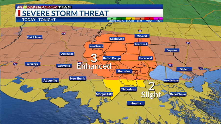
The Storm Prediction Center (SPC) has placed most of the area under an enhanced risk (3/5) for severe weather.
Threats
Severe Storms
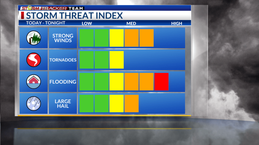
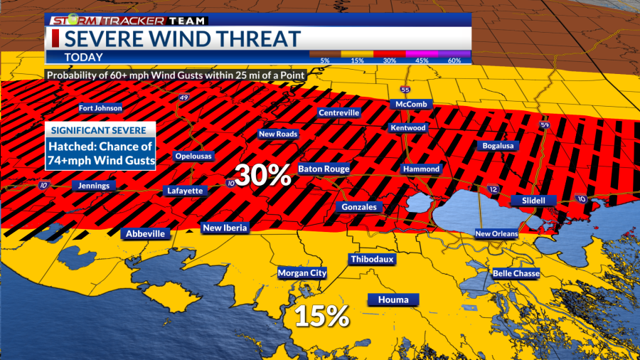
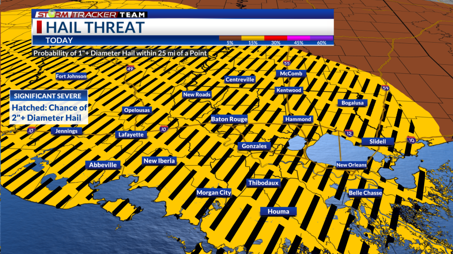
All hazards will be possible during each round of rain and storms. Damaging wind gusts will be the greatest concern. There is a chance that we may see some significant severe threats within the hatched areas below placed over the region for large hail (2″+ hail possible) and damaging winds (74mph+ gusts possible). The tornado threat is lower, but cannot be ruled out either.
Severe threats Severe wind threat Severe hail threat
Flash Flooding
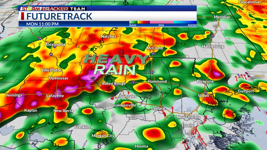
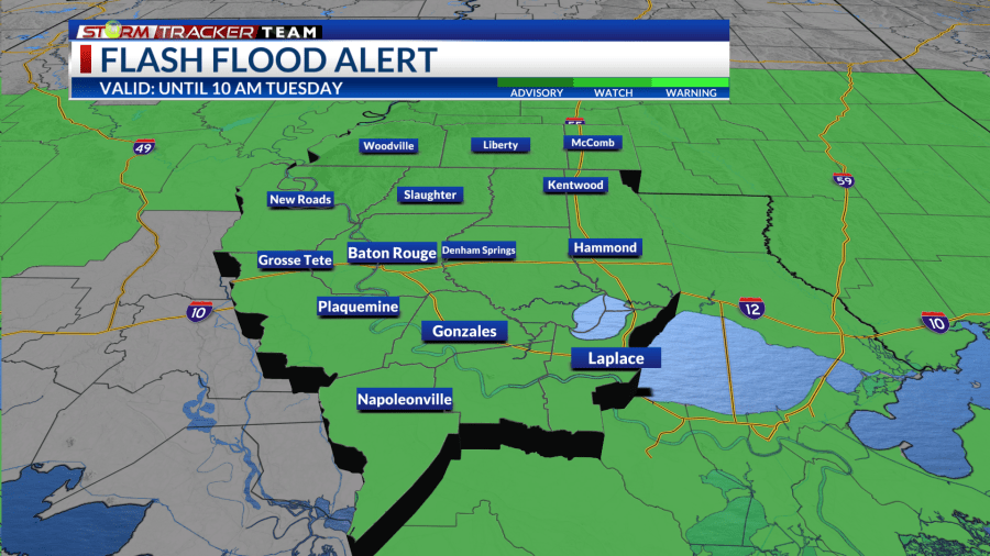
As we’ll see multiple rounds of rain and storms, heavy rainfall will be possible and may accumulate to high totals. Through Tuesday, Southeast Louisiana may see around 3-5″ of rainfall with locally high amounts of up to 6″ inches possible. This causes flash flooding concerns, especially for urban, low-lying, and poor drainage areas.
The Weather Prediction Center (WPC) has extended the moderate risk (3/4) for flash flooding over western portions of the area.
A Flood Watch will be in effect for the entire area through 10 a.m. Tuesday. Use extra caution when driving and never drive into flooded roadways. Turn around, don’t drown.
Timing
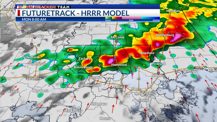
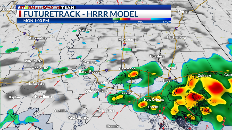
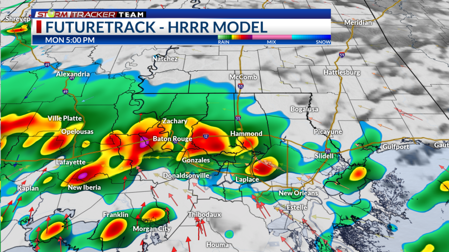
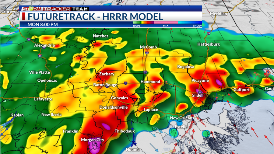
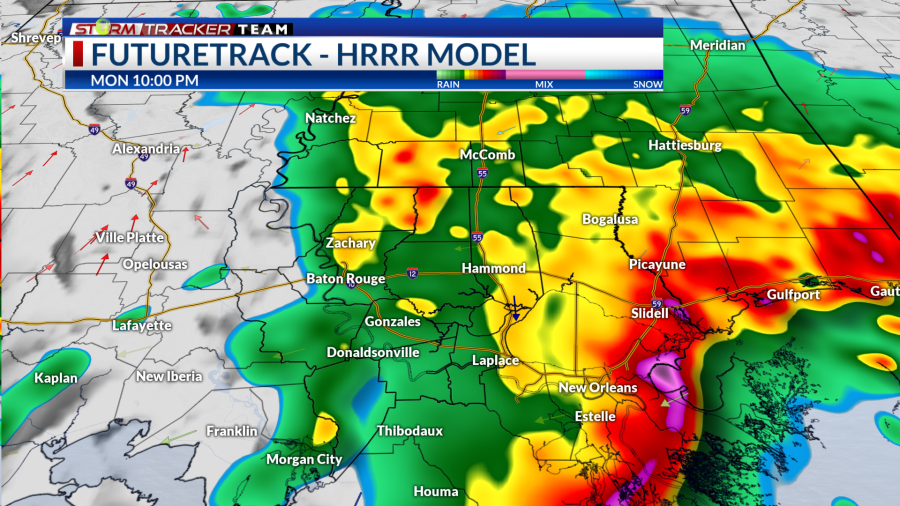
A few showers may linger into the afternoon hours, but we may see a lull in the widespread storms. Then, the second round will begin to take shape into the late afternoon and overspread the region towards the evening. Rain will persist into the night before beginning to clear out after midnight for most of area.
Morning Afternoon Evening Late Evening Tonight
How to prepare
Be sure to have multiple ways to receive weather alerts and stay tuned to updated forecasts during the day. Make sure your phone is unmuted, charged and turned on for notifications. Turn off your do-not-disturb and take your phone off of silent mode so those alerts can reach you.
‘Ahead of the Storm’: What to know, how to get ready before tornadoes, strong storms, heavy rain
With an overnight aspect to this event, make sure any alerts or warnings can wake you up as well.
Have a plan and a safe place to go if a warning is issued for your location. Find a lower-level, interior room away from windows.
You can always check out the Interactive Radar here. For the latest forecast information, check out our weather page.
Remember that you can download our weather app in the App Store and on Google Play. Just search for “BRProud Weather.”
Follow and keep up to date with the Storm Tracker Team:
Chief Meteorologist Sam Parish – Twitter | Facebook | sparish@brproud.com
Meteorologist Brandon Lashbrook – Twitter | Facebook | blashbrook@brproud.com
Meteorologist Ashley Renee – Twitter | Facebook | arenee@brproud.com
For the latest news, weather, sports, and streaming video, head to BRProud.com.

