Arkansas Storm Team Blog: Several chances for strong to severe storms

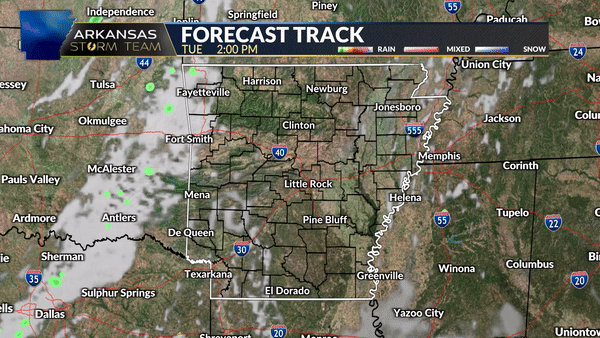
Storm chances return to the Natural State tonight, Tuesday, May 21st, and continue through the next few days.
Tonight the threat is mainly for northern, western, and parts of central Arkansas. This risk area is a low, level 2 out of 5, risk for severe storms. Even with a low risk for severe storms, it’s still important to be weather aware.
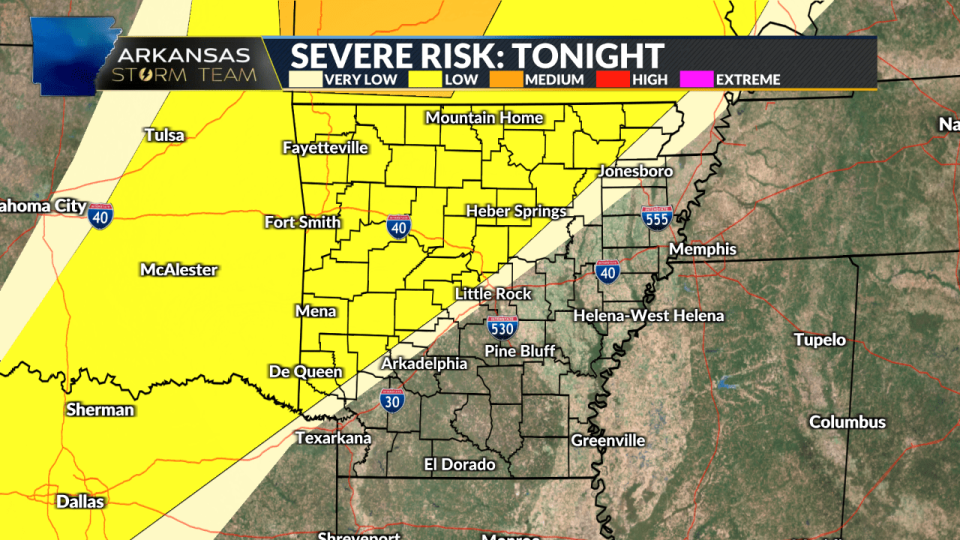
There is a Tornado Watch for NWA including: Benton, Carroll, Madison & Washington Counties. A watch does not guarantee a tornado will form, but does indicate the ingredients are present in the environment for development.

Cities under the tornado watch until 10 p.m. cdt include: Bentonville, Fayetteville, Eureka Springs, Huntsville, Boston, Winslow, Bella Vista and Siloam Springs.
These storms are expected to move in this evening and push through during the overnight hours. Large hail and heavy rain will be the main threats, however damaging wind gusts and an isolated tornado cannot be ruled out.
Wednesday will bring a more widespread chance for strong to severe storms, with a level 3 out of 5 risk covering much of the state.
Large hail and heavy rain will continue to be the main risks with any severe storms that develop on Wednesday. However, damaging wind gusts and a tornado or two will be possible, even with the lower risk for those.
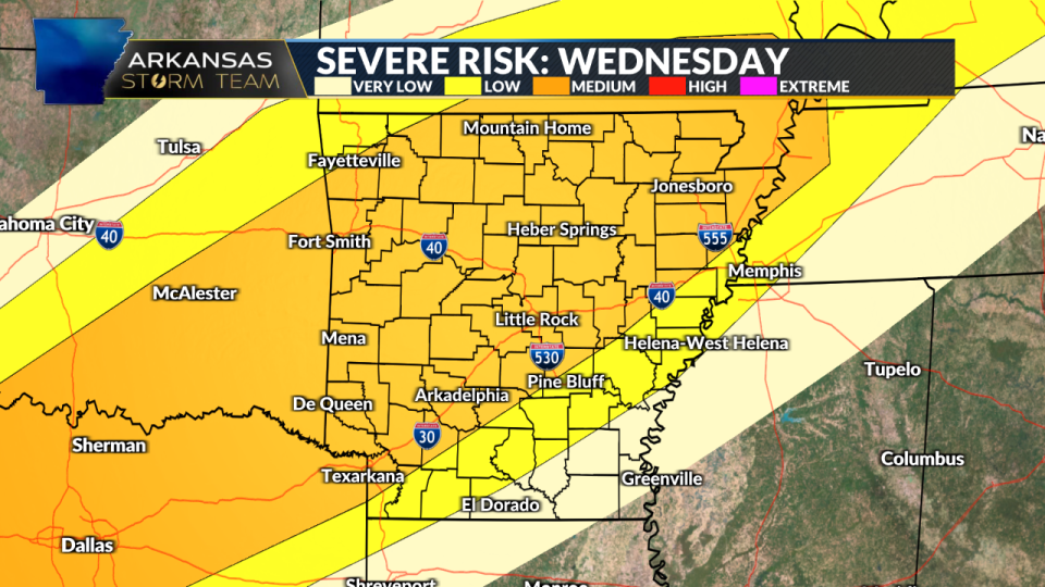
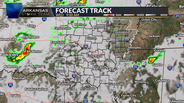
Wednesday’s storms are expected to come in two waves. One arriving late morning/ early afternoon, and one moving in during the evening hours.
Thursday also brings us a low-end risk for severe weather with much of the state under a low, level 2 out of 5, risk for severe storms.
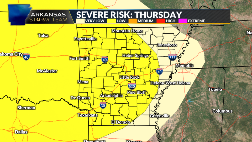
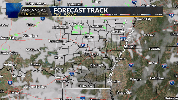
Thursday looks to have lots of dry time during the afternoon hours, with a cluster of storms moving into western Arkansas late Thursday night and into early Friday morning.
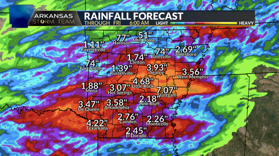
Some areas could see several inches of rainfall from Tuesday night through Friday morning. Those areas with the most thunderstorm activity will have the highest rainfall totals. Flash flooding could be an issue in those areas that see several thunderstorms.
With an unsettled weather pattern expected over the next few days, stick with The Arkansas Storm Team for continued updates. One way to stay weather-aware is by downloading The Arkansas Storm Team App below.
Download the Arkansas Storm Team app
To make sure you are staying up-to-date with the forecast, download the Arkansas Storm Team app to get updates anywhere at any time.
To watch the latest video updates from the Arkansas Storm Team, you can check them out here.
The Arkansas Storm Team is a collaboration of two stations to bring you the largest weather team in the state when covering Arkansas weather.
Copyright 2024 Nexstar Media, Inc. All rights reserved. This material may not be published, broadcast, rewritten, or redistributed.
For the latest news, weather, sports, and streaming video, head to KARK.

