These areas in San Diego County are at the highest risk of flooding, data shows

SAN DIEGO (FOX 5/KUSI) — With more rain comes the risk of flooding, even during average seasonal rainstorms, according to the County of San Diego.
There have been multiple flood events throughout San Diego County within the past decade due to intense or long periods of rainfall, according to the County of San Diego website, including the historic flooding that struck the region in January and early February.
Pacific storm to bring rain, wind to San Diego County this weekend
The central and eastern parts of San Diego County could suffer the most impacts from flash floods due to their terrain, which mostly consists of canyons, dry creek beds and high deserts. (See maps below).
Chollas has been designated a flood-prone area. Mission Valley has been designated as flood-prone. Sorrento Valley has been designated as flood-prone. The Tijuana River Valley has been designated as flood-prone.
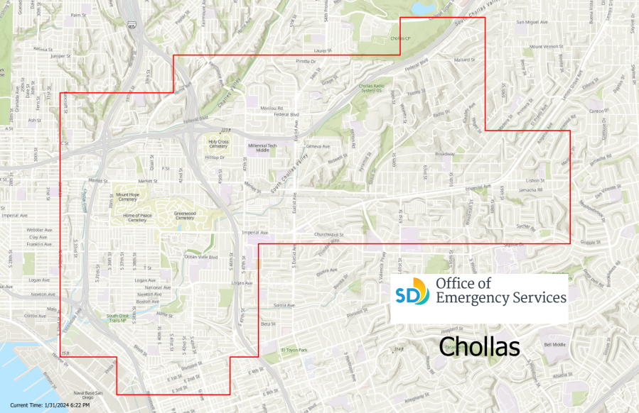
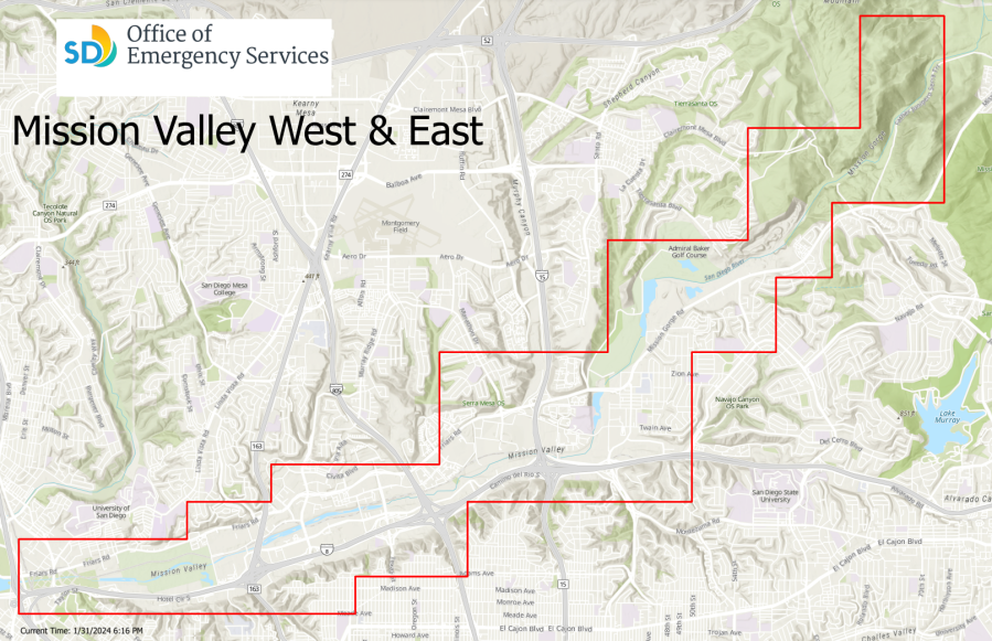
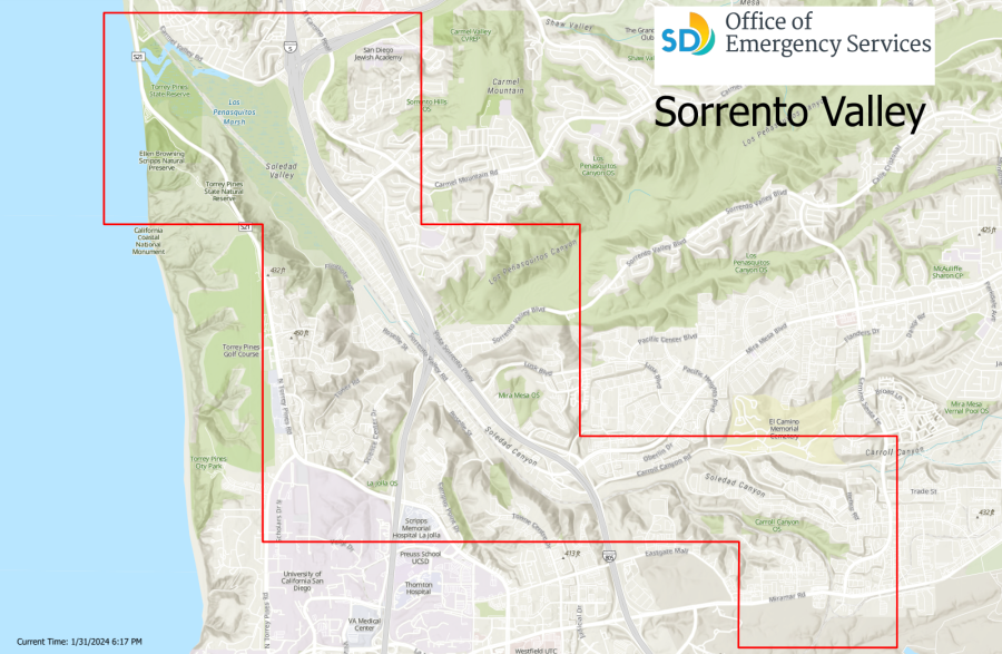
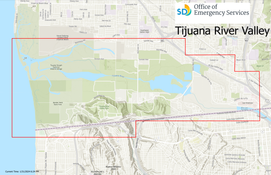
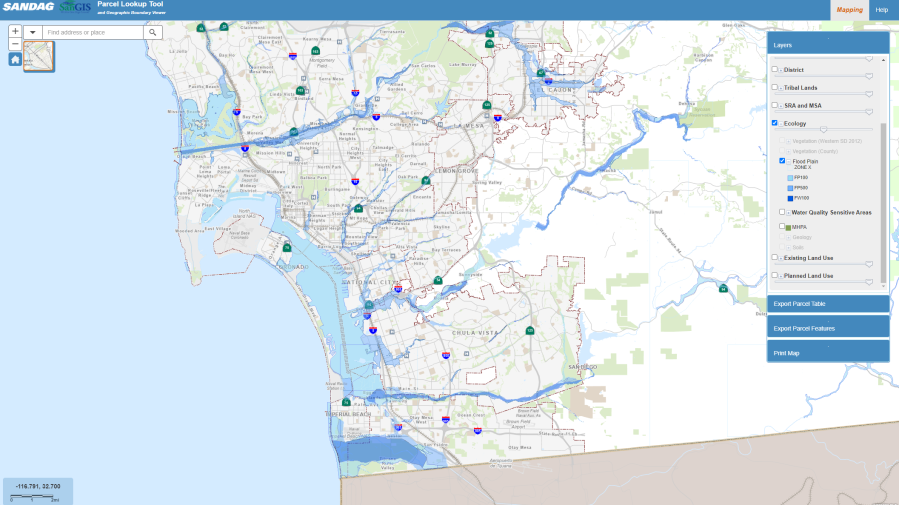
Within the city limits of San Diego, Chollas, Mission Valley, Sorrento Valley and the Tijuana River Valley have been identified as the most flood-prone areas.
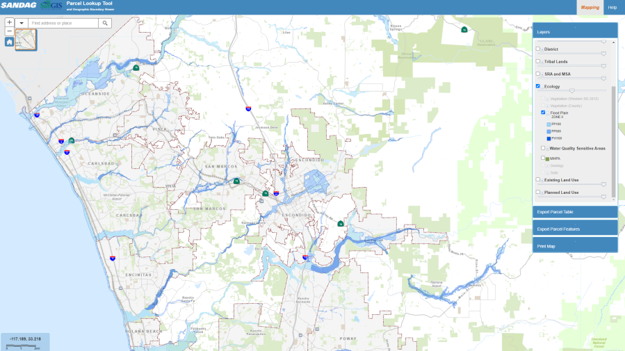
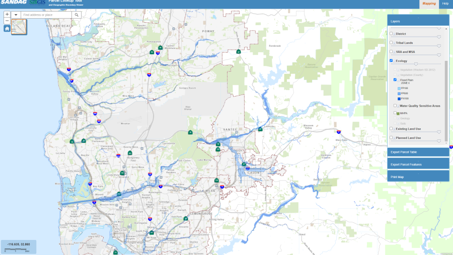
According to a map by the San Diego Geographic Information Source (SanGIS), a joint partnership between the City of San Diego and the County of San Diego, parts of El Cajon and Santee and Poway have also been designated as flood plains, as well as areas in North County such as Oceanside, San Marcos, Escondido and Encinitas. A large portion of Del Mar and Solana Beach are also flood-prone. (See maps below).
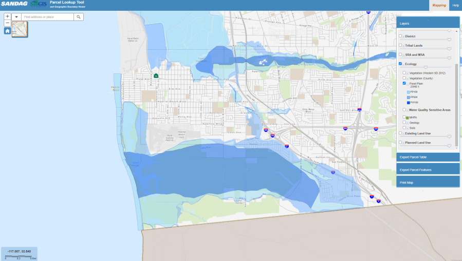
Areas in North County that are prone to flooding are shaded in blue. Areas in central San Diego that are prone to flooding are shaded in blue. Areas in South County that have been designated as flood-prone are shaded in blue. These parts of the Tijuana River Valley, shaded in blue, is flood prone, according to SanGIS.
Using definitions by the Federal Emergency Management Agency (FEMA), the map provides information on flood elevations based on a one percent annual chance of flooding (FP100) or a 0.2 percent annual chance of flooding (FP500).
Tijuana River Valley is shown as a particularly high-risk area, as well as anywhere bordered by bodies of water including the Otay River, the Sweetwater River, the San Diego River, the Los Penasquitos Marsh, the Escondido Creek, the Santa Ysabel Creek and the San Dieguito River.
According to the National Weather Service, during a flood, people should get to higher ground as soon as possible. It only takes about six inches of moving water to knock someone off their feet. The NWS also advises people not to drive into flooded roadways or around barriers because even just a foot of water can float a car or small SUV and just 18 inches of water is enough to carry large vehicles.
To find tips on how to stay safe before and during a storm, visit the City of San Diego’s storm preparedness webpage.
For the latest news, weather, sports, and streaming video, head to FOX 5 San Diego & KUSI News.

