Another wintry, windy storm to pummel the midwestern US at midweek
With a massive, late-season snowstorm fresh in the memory of Midwesterners, another storm is expected to spin up in the central United States at midweek.
While this system is expected to produce a more narrow swath of snow than this past weekend's storm, many will still receive enough snow to blanket lawns and cars on Thursday morning.
"With the high April sun and temperatures near freezing, the snow will have difficulty accumulating on roads," said AccuWeather Meteorologist Brian Thompson.
"However, in heavier bands of snow, roads may become snow-covered, even during the daylight hours."
Light snow can more easily stick to paved surfaces at night when temperatures are below freezing. Anyone with early morning commutes or exercise routines will need to be especially cautious of slick roads and sidewalks before, during and shortly after sunrise on Wednesday and Thursday.
While heavy accumulation is not expected on roadways, motorists throughout the Midwest will face strong winds and limited visibility due to blowing snow for the duration of this storm, regardless of the time of day.
Operators of high-profile vehicles will need to be especially vigilant. Power outages are also a threat as a result of powerful wind gusts.
Wind and snow could combine to cause airline delays in and out of Minneapolis and other airports in the region as well.
This month is already the snowiest April on record in both Sioux Falls, South Dakota, and Minneapolis, both of which are expected to receive accumulating snow.
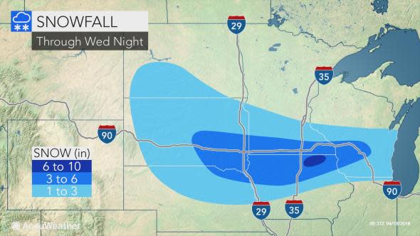
"Unlike the weekend blizzard, this will be a much weaker and fast-moving system, so most places will receive less than 6 inches of snow," Thompson said.
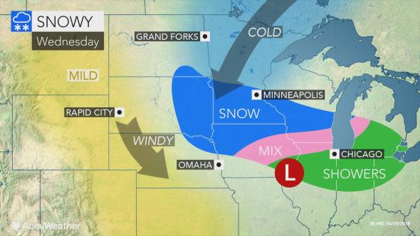
Parts of South Dakota, Nebraska, Minnesota, Iowa and Wisconsin will receive the highest snowfall amounts as the storm sweeps through on Wednesday.
A surge of cool air is poised to spill into the region following the snow and last through at least the end of the week, although forecast high temperatures are above freezing levels. While peeks of daytime sunshine will accelerate melting snow on Thursday and Friday, overnight black ice conditions may lend to travel issues during the early morning hours.
