Rain, snow hit SoCal, with chance for flooding, landslides, hail and even a tornado
Southern Californians have been hit Wednesday with another round of rain and snow, with precipitation picking up later in the day, prompting concerns about possible flooding, landslides and even a tornado.
The biggest threat from the system is unpredictable, severe thunderstorms, which could bring flash flooding in the afternoon and evening to some communities along the coast and valleys, with a flood advisory in effect through 8 p.m. Depending on a thunderstorm's strength, weather officials warned of the possibility for hail, strong winds, waterspouts off the coast and a weak tornado inland.
“That just depends where thunderstorms may develop," Rich Thompson, a National Weather Service meteorologist in Oxnard, said Wednesday afternoon.
Widespread rain totals are still not expected to surpass an inch, Thompson said, but if some areas see stronger thunderstorm cells, that could push up precipitation amounts.
Wednesday afternoon weather officials upgraded much of central and southwest Los Angeles County, and Ventura, Santa Barbara and San Luis Obispo counties to a flood advisory, warning of minor flooding and landslides.
"This additional rain will result in minor flooding," a flood advisory that was issued around 2 p.m. warned. "There is a small chance for more significant flooding and landslides to develop in isolated locations later this afternoon into the evening."
Read more: Lake Elsinore reaches new depths thanks to recent storms
In Los Angeles and Ventura counties, the weather service said many locations will experience flooding, including Long Beach, Thousand Oaks, Malibu, Wrightwood, Griffith Park, Burbank, Hollywood, downtown Los Angeles, Pasadena, North Hollywood, Alhambra, Beverly Hills, Culver City, Van Nuys, Mt. Wilson, Inglewood, Encino and Santa Monica.
Throughout the day Wednesday, the National Weather Service also issued several maritime and coastal warnings about dangerous winds, hail and waterspouts from the storm.
"In the thunderstorms, there could be rain rates up to an inch per hour — a heavy downpour,” said Rose Schoenfeld, a meteorologist for the National Weather Service in Oxnard. That would be isolated to a limited number of areas, she said, but it's hard to predict exactly where or when the storms would hit.
Widespread rain is expected from Santa Barbara through San Diego as the cold low-pressure system moves in from coastal waters off Point Conception early Wednesday, making its way southeast over the subsequent 48 hours.
"The rain totals will range anywhere from one-quarter [of an inch] to as much as 1 inch of rain,” said Mark Moede, a National Weather Service meteorologist in San Diego. “One hundred percent of the area is going to see some rain. It's just a matter of how much.”
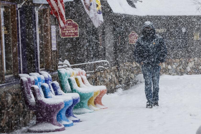
In the mountains, officials are expecting significant snowfall from the storm: up to 8 inches on the highest peaks in Los Angeles, Ventura and Santa Barbara counties, and up to 6 inches in the San Bernardino and Riverside county mountains.
Read more: Monster blizzard shatters California 'snow drought' with up to 10 feet of new snow
A winter weather advisory has been issued across Southern California mountains and will remain in effect from Wednesday afternoon through Thursday. In Los Angeles, Ventura and Santa Barbara county mountains, a dusting of snow could be possible as low as 4,500 feet, and at higher elevations — including the Interstate 5 and Highway 14 corridors — the National Weather Service warned that "travel could be difficult to impossible."
Rain is expected to wrap up by late Wednesday in L.A. County but could linger into Thursday farther south, while mountain snow will taper off by Thursday afternoon, Schoenfeld said.
“We’re looking at a dry period Friday through Sunday," Moede said, "just in time for daylight savings."
However, a high surf warning will remain in effect Thursday and Friday along L.A. and Ventura county beaches, where dangerous rip currents are expected and waves could reach up to 11 feet, according to the National Weather Service.
Read more: After landslides, limited train service resumes along troubled Orange County rail line
This story originally appeared in Los Angeles Times.

