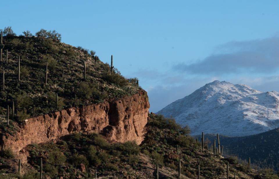
Arizona will see warmer weather, melting snow and increasing flood risk in these areas
Warm weather is on the horizon for metro Phoenix this weekend as temperatures hit the 80s through much of the region.
Dry weather will last through Monday as temperatures warm through the low to mid-80s, according to National Weather Service Phoenix.
"The warmest temperatures so far this year will continue through the weekend and extend into early next week," the weather service said.
Temperatures in the lower desert will reach the low 80s as early as Friday, with a high likelihood of afternoon highs reaching or exceeding 80 degrees Friday through Sunday. Light breezes will accompany the warmth.
Overcast skies throughout the weekend were expected to keep temperatures warm until Monday and Tuesday, the weather service said. Low chances of precipitation were expected to accompany the cloudy skies on Saturday and Sunday, though the showers will be few and far between.
Weather news:La Nina, which worsens hurricanes and drought, is gone after 3 years
Cloudy and rainy weather in northern Arizona
Rain accompanied by increased cloud cover was expected across northern Arizona over the weekend and into early next week as a Pacific moisture front moves over the state, the National Weather Service Flagstaff said.
There was a chance of snowfall in very high elevation areas of the high country starting Friday, though rain and increased dew point temperatures are the most likely weather impacts.
"Accumulating rainfall looks to extend from the Kaibab Plateau and expand west and south down toward Happy Jack," National Weather Service Flagstaff said in a weekend weather forecast discussion.
The weather service said high country residents should plan for increased snowmelt from the incoming weekend rainfall.
Friday will see increased southwest winds and seasonable temperatures across the area. Increased cloud cover across the region will result in chances of rain throughout Friday afternoon and evening. Saturday and Sunday will follow suit with breezy winds, rain chances will increase on Saturday with temperatures at a seasonal average. Sunday will bring mostly sunny skies with decreased rain chances. Temperatures could get as high as 70 degrees in some areas.
The calm and dry conditions will be interrupted by late Tuesday as a winter storm was expected to hit the high country on Tuesday afternoon. Though the full impact of the winter storm can't be determined until later in the week, the weather service said increased precipitation is expected.
"For now, it's noteworthy to say additional precipitation looks to be an impact that will likely result in increased snowmelt," National Weather Service Flagstaff said in a forecast discussion.
Allergy sufferers beware!Spring arrives weeks early. Here's what to expect
Flood warnings in Tonto Creek and Salt River
Flood warnings, which expire at 2 p.m. Tuesday, were issued for Tonto Creek and the Salt River due to high water levels caused by snowmelt as a result of the warming temperatures. The rapid snowmelt is expected to cause elevated water flow in many creeks, streams, lakes and washes across Arizona's lower desert regions.
SRP is releasing water from Salt River Project reservoirs in order to make room to accommodate the snow melt as snow in high elevation areas begins to melt throughout the Spring, with this weekend expected to see increased snow melt as temperatures warm.
The next several weeks of warmer temperatures is expected to bring elevated runoff from snow packs into lakes, rivers, creeks and dams. The runoff will be especially large this Spring as a result of the moisture heavy winter storms during the first two months of the year, according to the Arizona Department of Water Resources.
"They need to release water in order to prevent any sort of dam failure," said National Weather Service Phoenix meteorologist Gabriel Lojero. "They're releasing that water and as a result we're seeing these elevated water flows along the Salt River."
The flood warning will be in effect until Tuesday and covers the Salt River between Granite Reef Dam and Tempe Town Lake, according to Lojero.
The weather service said that floods will impact unbridged crossings and low-lying roads near washes. Crossings especially along 67th Avenue and 91st Avenue west of Loop 202 in metro Phoenix are expected to be especially impacted by flooding as elevated water flows continue.
"Right now there is not imminent flood danger," said Lojero. "But, as we continue to see elevated flows there's a potential for some minor flooding in those areas."
'Weather chaos':Storms bring enough snow to fill Verde River reservoirs
How do I drive through a flooded area?
The Arizona Department of Transportation recommends the following safety tips for driving near flooded areas:
Don’t risk crossing a flooded wash, even if it doesn’t look deep. It's easy to underestimate the power of running water; just a foot can carry off a vehicle.
Avoid areas where water is pooling in travel lanes; if possible, use center lanes and drive in the tracks of the vehicle ahead of you.
Do not drive around ‘Road Closed’ signs. You risk your life and face being cited under the state’s stupid motorist law.
If traffic lights are out, treat an intersection just like a four-way stop.
Expect the unexpected. Have extra supplies, including an emergency kit and drinking water, in case you experience an extended highway closure.
Storm runoff can loosen boulders and rocks on slopes above highways. Stay alert in rockfall-prone areas.
Before you drive, inspect your windshield wipers and replace them if necessary.
Turn on your headlights while driving.
Avoid sudden braking, which can cause you to slide on the wet pavement. To slow down, take your foot off the gas pedal and brake slowly.
The tires of larger vehicles, like trucks and buses, create spray that can lessen visibility, so don’t follow them too closely.
Be cautious of hydroplaning. If you feel you are hydroplaning, ease your foot off the gas pedal until you regain traction. Do not brake suddenly. If you are sliding or drifting, gently turn your steering wheel in the direction of your slide.
Tranquil weather expected in Tucson
Tucson will follow the warming trend with above-average temperatures accompanied by light clouds and afternoon breezes expected over the weekend and into late next week.
Friday and Tuesday will see the highest temperatures in Tucson and the surrounding desert regions, with the high on Friday forecast at 82 degrees and the high on Tuesday expected to reach 83 degrees, according to NWS Tucson.
Saturday and Sunday were expected to be particularly breezy, with the strongest winds focused east of Tucson as a slight weather front moves over the area. Conditions will remain dry and warm throughout through the weekend, slight chances of rain are possible in areas north of Tucson, though they are not likely.
Wednesday will bring a chance of rain, cooler temperatures and winds as a winter weather front moves over the state's lower desert region.
This article originally appeared on Arizona Republic: Warming Arizona weather increases flood risks in parts of state

