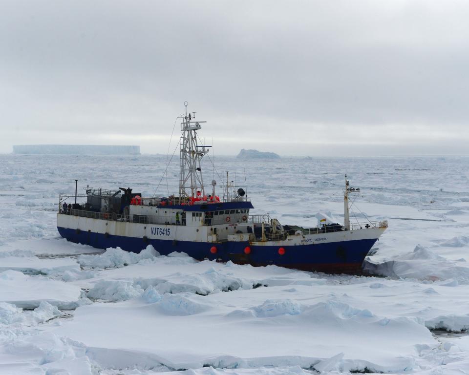
The Antarctic Chieftain, a 207-foot Australian-flagged fishing vessel, called for help on Feb. 10 when it suffered damage to three of its four propellers after becoming beset in the ice roughly 900 miles northeast of McMurdo Sound.
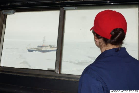
The U.S. Coast Guard cutter Polar Star, the nation's only heavy icebreaker, had to cut through 150 miles of ice that was up to 20 feet thick in some areas -- at times in whiteout conditions -- to reach the Antarctic Chieftain and rescue its crew of 26.
Eventually, the Polar Star brought the Antarctic Chieftain into open water, where it was able to maneuver under its own power.
The Polar Star had been in the area as part of Operation Deep Freeze, an annual mission to cut through the ice in McMurdo Sound and create a channel so that McMurdo Station can be resupplied.
The Polar Star is now heading to its home port in Seattle.
8.1
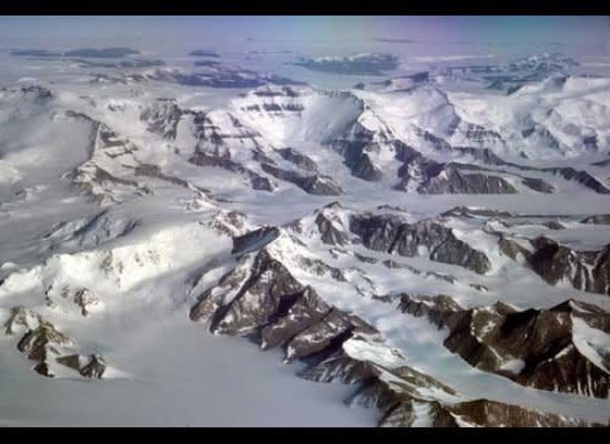
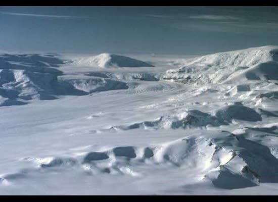
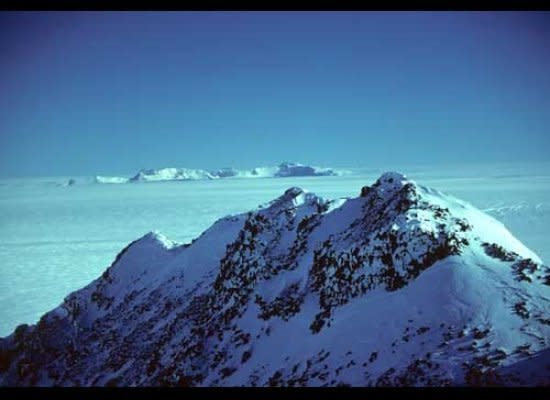
South of Beardmore Glacier, the Transantarctic Mountains are composed of high, blocky massifs topped by layers of flat-lying sedimentary rocks, as seen here in a portion of the Prince Olav Mountains. Shackleton Glacier flows to the right from the top center of the image.
8.2
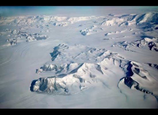
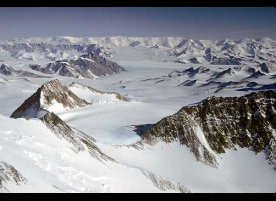
Liv Glacier flows for 45 miles from the polar plateau through the Transantarctic Mountains to the Ross Ice Shelf in the foreground. Byrd’s flight to the South Pole followed the left (east) side of the glacier. Mt. Fridtjof Nansen is the highest peak on the horizon to the east (left) of Liv Glacier.
8.3
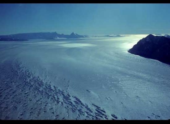
With broad bends in its upper reaches, Axel Heiberg Glacier descends steeply from the polar plateau. En route to the South Pole, Roald Amundsen’s party drove dog teams in a zigzag pattern up the ascending ramps, avoiding the steeper icefalls of the glacier.
8.4
Intricate ridgelines populate the central drainage of Amundsen Glacier, flowing from left to right in the middle ground. At the horizon, Rawson Plateau marks the boundary of the polar plateau.
8.5
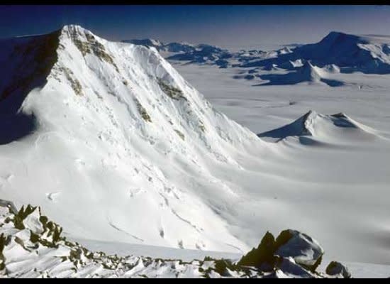
With a width of ten miles, the upper reaches of Scott Glacier spill subtly from the polar plateau, past Mt. Howe, 60 miles to the south, barely seen between the two nunataks (islands in ice) at the horizon.
8.6
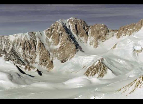
Mt. Early, Earth’s southernmost volcano, displays a yellow mantle at its summit composed of palagonite, a yellow, volcanic glass that was fragmented during the eruption of magma into overlying ice of the previously relatively higher East Antarctic Ice Sheet.
8.7
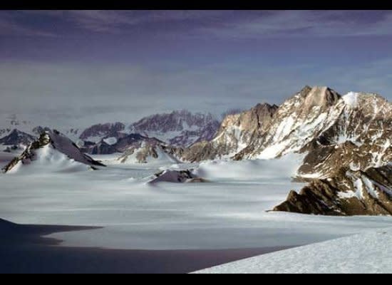
Mt. Howe, 25 miles distant, the southernmost outcrop of rock on Earth, as viewed from the summit of Mt. Early.
8.8
The majestic, unclimbed Mt. Astor is the highest peak in the Hays Mountains. All but the tip of the summit is massive granite, the top being horizontal sedimentary rock.
8.9
Grizzly Peak and Mt. Zanuck tower over the northern (right) flank of Sanctuary Glacier. The Hays Mountains merge into cloud on the far side of Scott Glacier, glimpsed flowing left to right in the gap between the low peaks in the left center of the image.
8.10
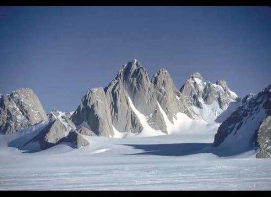
The Spectre, central spire of the Organ Pipe Peaks, fantasy of mountain, fastness beyond reach.
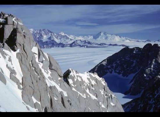
8.11
View from the shoulder of The Spectre across Scott Glacier (flowing left to right) to the Hays Mountains.
8.12
This view from the summit of Mt. Analogue reaches past the south side of Mt. Doumani, past the dark pyramid of Mt. Tellar, to ranges that bound Reedy Glacier 75 miles to the east. For the 75 miles beyond that, the Transantarctic Mountains dwindle in relief and width, and are finally overcome by the merger of the East and West Antarctic Ice Sheets.
Former NBA guard Darius Morris has died at the age of 33. He played for five teams during his four NBA seasons. Morris played college basketball at Michigan.
Jason Fitz and Frank Schwab join forces to recap the draft in the best way they know how: letter grades! Fitz and Frank discuss all 32 teams division by division as they give a snapshot of how fans should be feeling heading into the 2024 season. The duo have key debates on the Dallas Cowboys, New York Giants, New Orleans Saints, Los Angeles Rams, New England Patriots, Las Vegas Raiders and more.
This year’s Berkshire Hathaway annual shareholder meeting marked a new era for the Oracle of Omaha, Warren Buffett. It’s the investing legend’s first without his right-hand man, Charlie Munger.