Major storm targets East Coast ahead of holiday travel rush
The entire East Coast will soon feel the impact of a dangerous storm that's set to bring heavy rain and strong winds ahead of the holiday travel rush.
The worst of the rain -- 4 to 6 inches -- is forecast from Florida to the Carolinas.
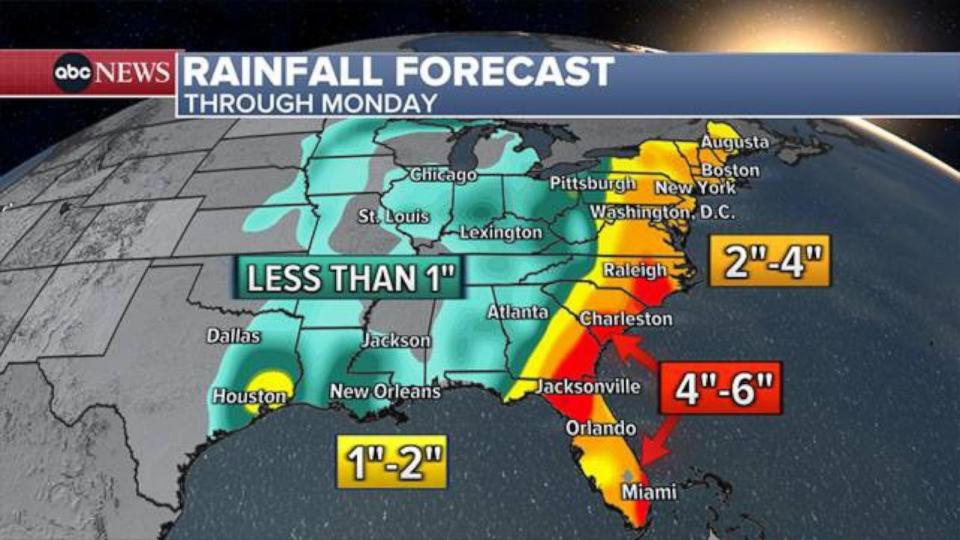
The torrential rain will first strike Florida on Saturday.
Severe thunderstorms are possible from Miami to Orlando to Tampa. Residents should be prepared for flooding, damaging winds and possible tornadoes.
MORE: 3 life-saving tactics to use if in a car during a flash flood
Flood watches have been posted for the Florida Keys and the Miami area, while high surf advisories and coastal flood warnings were issued along much of Florida's east coast.
Florida Gov. Ron DeSantis said he's activated the Florida State Guard.
I've directed @FLSERT to closely monitor the low-pressure system expected to impact the gulf coast this weekend.
I am also activating the @FLStateGuard to ensure we are prepared to respond to any impacts, including flooding, strong wind gusts & isolated tornadoes. pic.twitter.com/tIZVBCelNS
— Ron DeSantis (@GovRonDeSantis) December 15, 2023
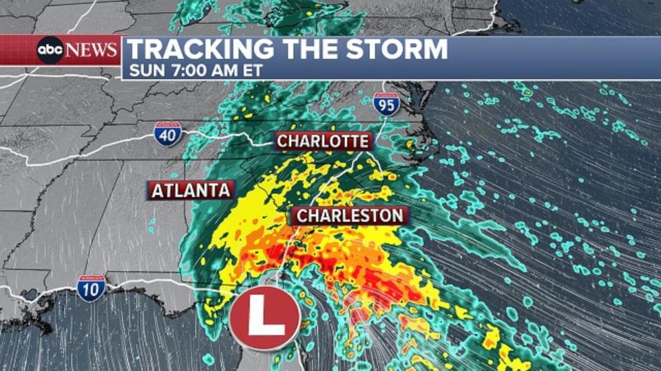
On Sunday morning, the storm will move north, bringing heavy rain, strong winds and coastal flooding to Georgia and the Carolinas.
Flash flooding will be possible in Savannah, Charleston and Charlotte.
On Sunday afternoon, the storm will push into the Northeast.
The bulk of the heavy rain will hit Sunday night along the Interstate 95 corridor, where 2 to 3 inches of rain is forecast. Flash flooding is possible, especially in urban areas.
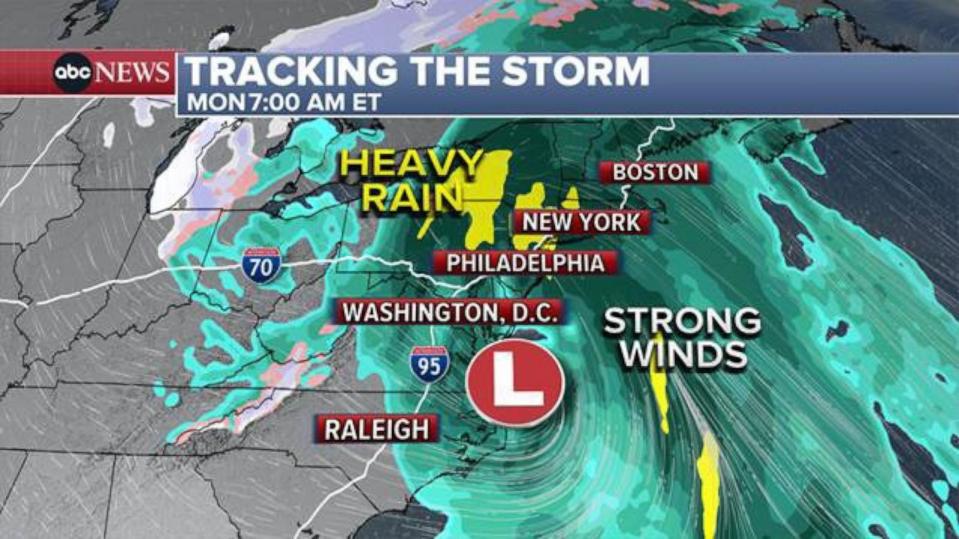
By Monday evening, the storm will exit New England.
Major storm targets East Coast ahead of holiday travel rush originally appeared on abcnews.go.com

