Major storm to bring flooding threat, damaging winds to West Coast
After significant rainfall last week, the West Coast is bracing for another major storm that is expected to bring the threat of flooding rain, damaging winds and mudslides.
A "potent atmospheric river" will start impacting Northern California on Wednesday, before moving to the central and southern coast into Thursday, the National Weather Service said.

Damaging winds gusts of at least 50 mph are forecast Wednesday as the front moves in, with gusts up to 70 mph possible near the coast. The gusty winds may down trees and cause power outages, the agency warned.
The storm will bring "substantial rainfall to the San Francisco Bay Area and Central Coast on top of already saturated soils," the National Weather Service said.
MORE: San Francisco sees record rain as flooding shuts down highway
Excessive rain, with river flooding and flash flooding, is possible. Some rivers, like the Russian River, are expected to rise more than 20 feet in just over 24 hours.
"As a result look for rapid rises in area creeks, streams, and rivers. Bankfull exceedance is possible," the National Weather Service said.
Recent burn scars will also be vulnerable to flooding and debris flows, the agency said. The California Governor's Office of Emergency Services advised residents who live near or downslope of burn areas to have a plan to quickly evacuate in the event of flash flooding or mudslides.
Santa Barbara County officials issued an evacuation order Wednesday afternoon, effective immediately, for residents living near three fire burn scars, citing the potential for "flooding and mud and debris flows" due to the storm.
The storm is coming! #CAwx #BayAreaWX #CArain #AtmosphericRiver pic.twitter.com/8gH4aGKl48
— NWS Bay Area 🌉 (@NWSBayArea) January 4, 2023
California Gov. Gavin Newsom signed a stateside emergency declaration Wednesday morning to support response and recovery efforts to communities impacted by the winter storm, officials said. Flooding impacts will likely last into the weekend before another potentially impactful storm is anticipated early next week, the state's Office of Emergency Services said.
"The governor was clear in his directive -- to take every available action to keep Californians safe during this storm," Nancy Ward, director of the California Governor's Office of Emergency Services, said during a news briefing Wednesday. "We anticipate that this may be one of the most challenging and impactful series of storms to touch down in California in the last five years."
Bay Area preparing
The worst of the current storm is expected to hit Northern California, including the Bay Area, Wednesday afternoon into the evening.
"Between 3 and 7 p.m. you do not want to be on the roads anywhere in the Bay Area," ABC News chief meteorologist Ginger Zee said.

The heavy rain will move into Los Angeles Wednesday night into early Thursday morning, with flash flooding possible.
Over the next few days, 2 to 4 inches of rain is possible from San Francisco to Los Angeles, with 4 to 8 inches forecast in the mountains.
The excessive rain comes days after San Francisco reported its second-rainiest day ever, when over 5 inches of rain fell on New Year's Eve.
San Francisco Mayor London Breed said during a press briefing ahead of the storm that the city is anticipating "something just as significant" on Wednesday.
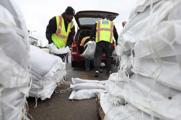
Ahead of the storm, the city activated its Emergency Operations Center to clear storm drains, distribute sandbags and "ensure residents are prepared," Breed said.
The storm is forecast to then bring heavy snow as it moves into the Rockies Thursday and Friday, where up to a foot of snow is expected. Avalanche danger will be high.
3rd atmospheric river in a week
This is the third atmospheric river storm to bring significant rainfall to the region in a little over a week.
The long, narrow regions in the atmosphere are like "rivers in the sky," according to the National Oceanic and Atmospheric Administration. They carry large amounts of water vapor over the Pacific Ocean, which is released as rain in lower elevations or snow in higher elevations when they make landfall.
The events are "tied closely to both water supply and flood risks," NOAA said. Extreme rainfall from an atmospheric river can also cause mudslides, it said.
MORE: What are atmospheric rivers? How climate change impacts the storms they produce
California experienced two major atmospheric rivers last week -- first on Dec. 27 and then over New Year's weekend. Based on the amount of water vapor and the duration of the event, the first two were considered to be in the 3 to 4 range in terms of severity, on a scale of 1 to 5, according to Karla Nemeth, director of the state's Department of Water Resources.
"This event that we're experiencing now is about a 3 -- that's because less water vapor and shorter duration," Nemeth said during the state's press briefing. "What is important about this event is it is coming with high winds, and we anticipate that that will be the primary impact."
Downed trees are likely due to extreme drought conditions in the state alongside the saturated ground, which could lead to flooding and power problems, she said.
"This is a significant weather event," Nemeth said.
ABC News' Max Golembo contributed to this report.
Major storm to bring flooding threat, damaging winds to West Coast originally appeared on abcnews.go.com
