Hurricane Lee now a Category 4: Projected path, maps and tracker
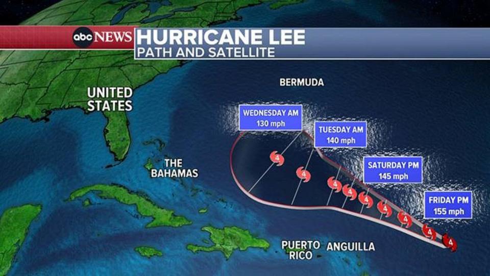
Hurricane Lee is churning over the Atlantic Ocean as a powerful Category 4 hurricane with winds of 155 mph, just below the strength of a Category 5, which begins at 157 mph winds.
On Thursday, Lee strengthened from a Category 2 hurricane to a Category 4, and finally to a Category 5 by 11 p.m. ET.
MORE: Hurricane preparedness tips and resources to help keep your family safe
Lee will remain a powerful, major hurricane through the weekend.
Lee will bypass the northern Caribbean islands, sparing Puerto Rico and the U.S. Virgin Islands. The only impact on the islands will be 10-foot waves and life-threatening rip currents this weekend.
Hurricane Lee will slow down Sunday and early next week, allowing 10-foot waves to reach the Southeast U.S. mainland.
By Thursday, Lee will be near Bermuda, bringing waves up to 20 or 30 feet.
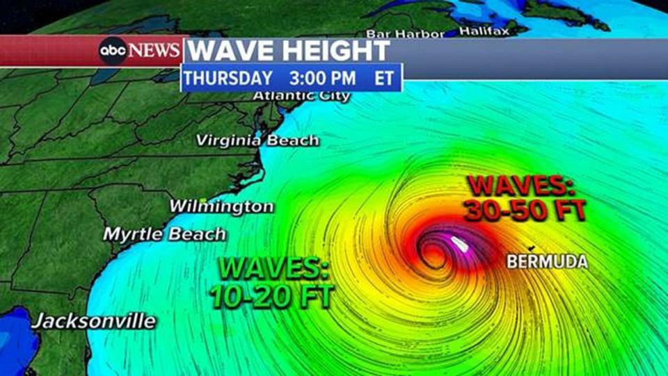
By Friday, as Lee passes east of the Northeast U.S. coast, waves reaching 10 to 20 feet will be possible along the coasts of New Jersey, Long Island and New England.
It is too early to predict Lee's path, but the latest models show Lee possibly making landfall near the Canada and U.S. border next Friday night into Saturday.
MORE: Hurricane categories explained: How strong is each category?
The Federal Emergency Management Agency has pre-deployed assets to Puerto Rico and the Virgin Islands, according to the White House.
President Joe Biden was briefed Thursday on the latest trajectory and FEMA's preparations, the White House said.
Hurricane Lee now a Category 4: Projected path, maps and tracker originally appeared on abcnews.go.com

