Heat waves, poor air quality and severe storms: US experiencing acute weather conditions from coast to coast
Potentially deadly weather conditions are affecting millions of Americans from coast to coast.
Extreme heat, poor air quality and severe storms bringing flash flooding threats will be plaguing regions all over the country on Sunday.
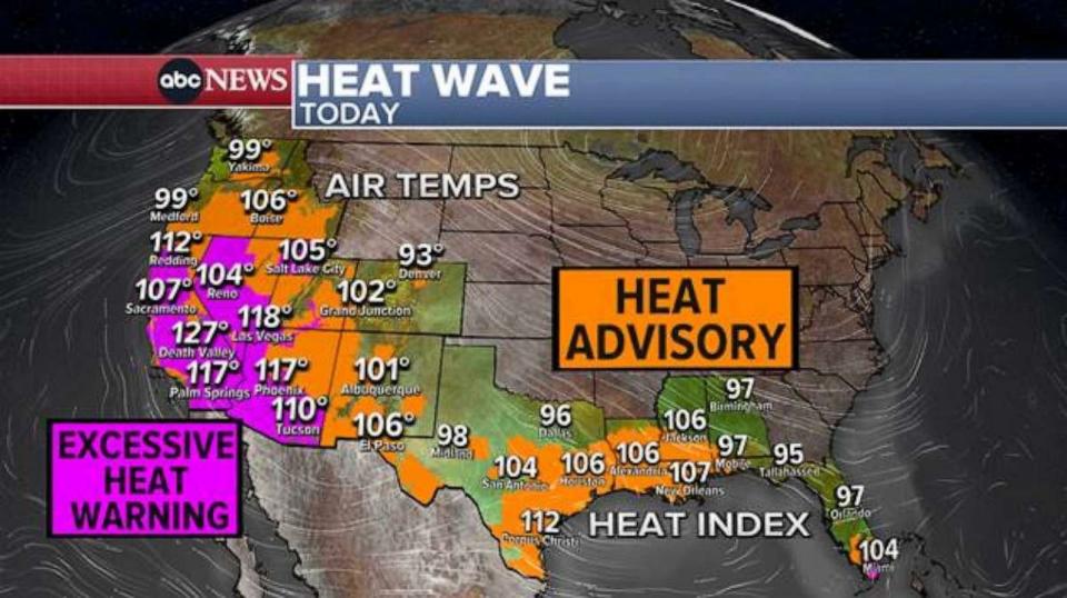
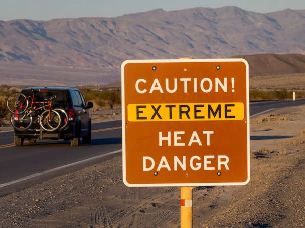
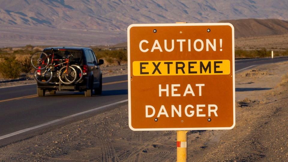
More than 80 million Americans across 14 states from Washington to Florida are currently under heat alerts.
The temperature at Furnace Creek in Death Valley, California, may reach 130 degrees for the first time since 2021, forecasts show. On Saturday, temperatures were measured at 126 degrees.
MORE: How does extreme heat affect mental health?
It has been the hottest first two weeks of July on record for Phoenix and Tucson, Arizona, as well as on the other side of the country in Tampa, Fort Myers and Key West, Florida.
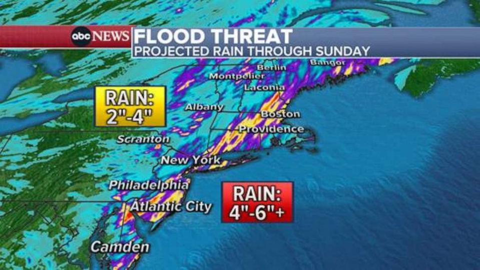
In the Northeast, more than 56 million people are under a flood watch, as heavy rain moves through on Sunday morning, causing flash flooding in parts of Virginia, Pennsylvania and New Jersey.
El Paso, Texas, has seen 100-degree days for 30 days in a row, crushing the former record. The forecast calls for triple-digit temperatures for at least the next week.
Elsewhere in the country, daily record-high temperatures are expected to be broken in at least 38 cities from Oregon to Florida, including cities in California like Palm Springs, Fresno and Sacramento; cities in Arizona from Flagstaff, Phoenix and Tucson; Las Vegas and Reno in Nevada; El Paso, Houston, Austin and Corpus Christi in Texas; and Salt Lake City.
On Saturday, Phoenix broke its daily record when it reached 118 degrees, continuing the stretch of temperatures past 110 degrees to 16 days.
The South is also still dealing with hot temperatures, with heat indexes along the Gulf Coast forecast to reach past 110 degrees in the upcoming week. Miami has been upgraded to an excessive heat warning through Monday as the heat index is expected to reach up to 112 degrees.
MORE: Why smoke from wildfires could cause a host of symptoms -- even in healthy people
The smoke that has been over the upper Midwest the last couple of days is about to make a push eastward as 900 wildfires continue to burn in Canada, the vast majority in British Columbia. More than half of the fires in Canada are characterized as “out of control.”
By 6 p.m. ET the smoke will have reached Cleveland and eastern Kentucky, forecasts show.
On Monday at 7 a.m. ET, the smoke will still be heavy from Montana to Nebraska, while the eastern plume of heavy smoke reaches along the East from western New York to the Smoky Mountains and Asheville, North Carolina.
By Monday afternoon, the smoke is expected to become very heavy over parts of New York and Pennsylvania. For now, New York City seems to remain only under light conditions through Monday.
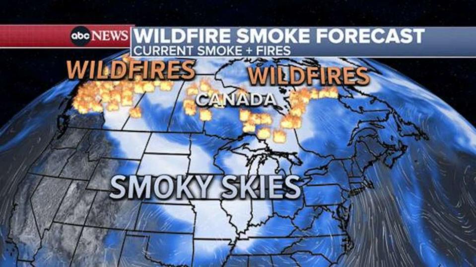
Areas from Montana to Chicago woke up to reduced air quality and hazy skies on Sunday morning, with Chicago among cities with the worst air quality in the world this morning, according to IQAir.
MORE: 3 dead amid flooding in Pennsylvania, with others reported missing, police say
The influx of precipitation is a continuation of flash flooding conditions that plagued the region on Saturday. More than 3 inches of rain fell in Williamsport, Pennsylvania, on Saturday, which caused flash flooding and killed at least five people.
The ground is already extremely saturated in much of the Northeast from more than a week of rainfall, which is increasing flood risks. The National Oceanic and Atmospheric Administration's Weather Prediction Center has issued a moderate risk advisory for excessive rainfall from Maine to Delaware, including large cities like New York City and Philadelphia, indicating that numerous flash floods are likely, with significant events possible.

A tornado watch has also been issued for 14 million people in the Northeast until 3 p.m. Included in the alert are much of Long Island, New York, all of Connecticut, much of Massachusetts, New Hampshire and parts of Rhode Island and southern Maine. Flash flooding and severe thunderstorm warnings had already been issued in those areas.
The heaviest and strongest storms will move through the Northeast on Sunday morning and through the afternoon. Storms are expected to quiet down by the evening, except for some lingering activity from upstate New York to Vermont, forecasts show.
Heat waves, poor air quality and severe storms: US experiencing acute weather conditions from coast to coast originally appeared on abcnews.go.com

