Late-Winter Storm Has Los Angeles Bracing For Yet More Rain, 40 MPH Winds And Potential Flooding

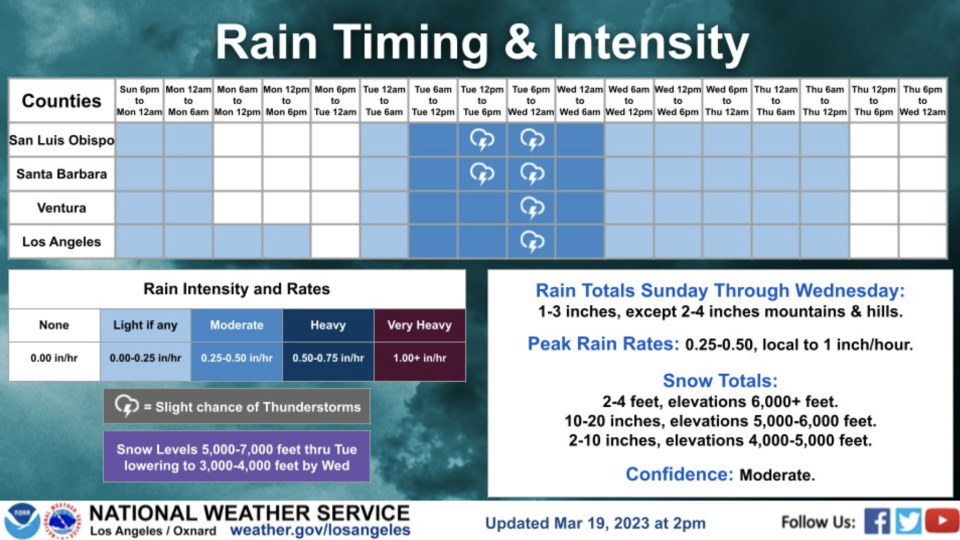
The National Weather Service today issued a Flood Watch for most of Los Angeles, Ventura, Santa Barbara, and San Luis Obispo Counties from late tonight through Wednesday afternoon. The NWS warned that “extensive street flooding and flooding of creeks and rivers are possible.”
Related Story
LAUSD Strike: Public Schools To Close Tuesday As 60,000 L.A. Teachers & Campus Workers Stage Three-Day Walkout
Related Story
Oscars Street Closures Set Around Dolby Theatre: Here Are The Maps
Related Story
Friday's Image Awards Red Carpet Canceled As Flash Flood Warning Issued For Los Angeles And Ventura Counties — That's In Addition To Blizzard Warning & Waterspout Concerns: Update
The waterlogged metropolis has already seen close to double its average annual rainfall, with the Department of Water and Power Headquarters in Downtown L.A. logging 31 inches of rain since October. The seasonal average there is 17 inches.
More from Deadline
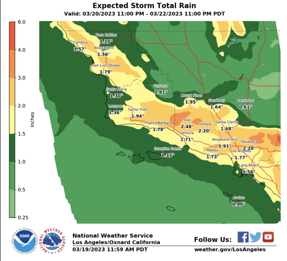
Forecasts put rainfall from the coming storm at 1-3 inches, with snow possible above 3500 feet and 2-5 feet of powder expected above 6,000 feet.
Heavy winds will accompany the storm, with the DWP warning of gusts between 40-60 mph. “Travel could be very difficult to impossible,” according to NWS. “Very strong winds could cause extensive tree damage.”
Thunder and lightning are possible on the back side of the system.
Best of Deadline
Sign up for Deadline's Newsletter. For the latest news, follow us on Facebook, Twitter, and Instagram.

