Tropical Storm Peter could bring rain, surf to Puerto Rico, and new storm could form
The Atlantic is looking crowded this week with two named storms and a possible third on the way.
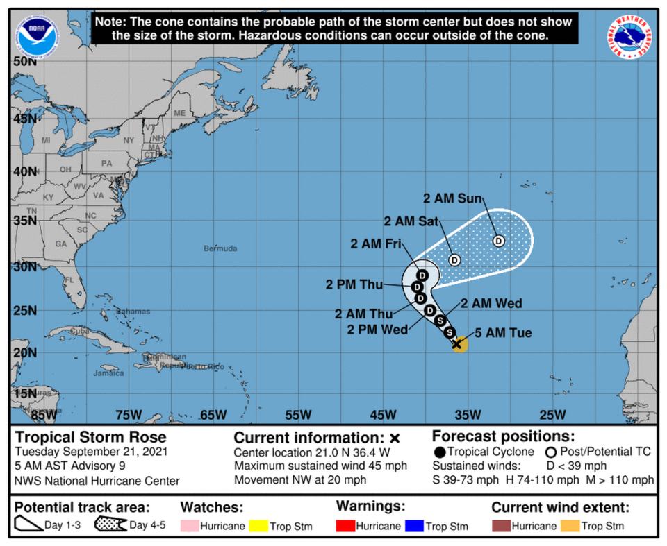
Tropical Storms Peter and Rose are still churning through the middle of the Atlantic, where they pose little threat, and a tropical wave several hundred miles south of the Cabo Verde Islands could become the next named storm — Sam.
The National Hurricane Center has been upping the system’s chances of development over the last few days, and as of 8 a.m. Tuesday it had a 50% shot of strengthening into a tropical depression in the next two days and a 90% chance of forming in the next five days.
Forecasters said it’s likely a tropical depression will form by Thursday or Friday as the system books it west at 10 to 15 mph.
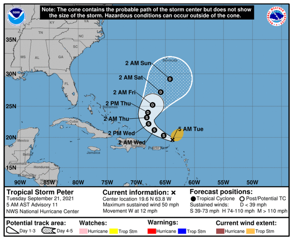
Tropical Storm Peter was about 140 miles north of Puerto Rico Tuesday morning, but the storm’s predicted path takes it up and away from the Caribbean and Florida this week as it weakens to a tropical depression.
As of 2 p.m., Peter had 35 mph maximum sustained winds and was headed west-northwest at 8 mph.
Puerto Rico and the Virgin Islands could see one to four inches of rain and some rough surf, but they’re outside of Peter’s tropical-storm-force wind field, which extends 175 miles from the center.
Tropical Storm Rose was hundreds of miles away from any possible land interaction Tuesday morning and looked to stay that way. It had 40 mph sustained winds at 2 p.m., and it was expected to continue to weaken a tropical depression as soon as Wednesday.
The other disturbance in the basin is the remains of Tropical Storm Odette. The system, about 700 miles west of the Azores, could strengthen a bit while it does a loop in some warm-ish waters this week, but forecasters said it was set to run into rough conditions by the end of the week.
They gave it a 20% chance of strengthening in the next two days and a 40% chance of strengthening in the next five as of the 8 a.m. update.

