UPDATE: National Weather Service confirms tornado hit Dundee Saturday morning
UPDATED AT 7:40 p.m.
A tornado passed through downtown Dundee Saturday morning, causing damage to buildings, vehicles and trees, the National Weather Service confirmed Saturday evening.
The EF0 tornado – the least severe on the Enhanced Fujita Scale used to measure tornado strength – touched down at 11:03 a.m. near the intersection of Petersburg and Brewer roads and traveled northeast for 7.3 miles before it lifted near the intersection of Dixon and Sullivan roads, the weather service office near Pontiac said in a news release.
Damage in the area of Brewer and Petersburg roads "included a stand of pine trees down, damage to an outbuilding, and some significant shingle damage to a house with winds estimated at 75 mph in strength," the release said.
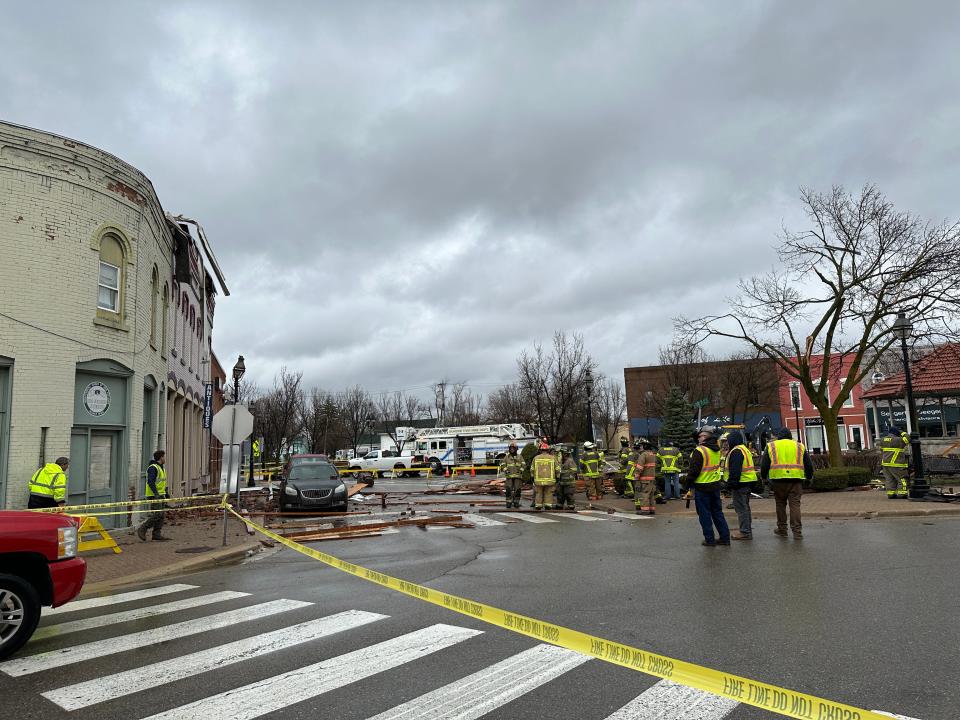
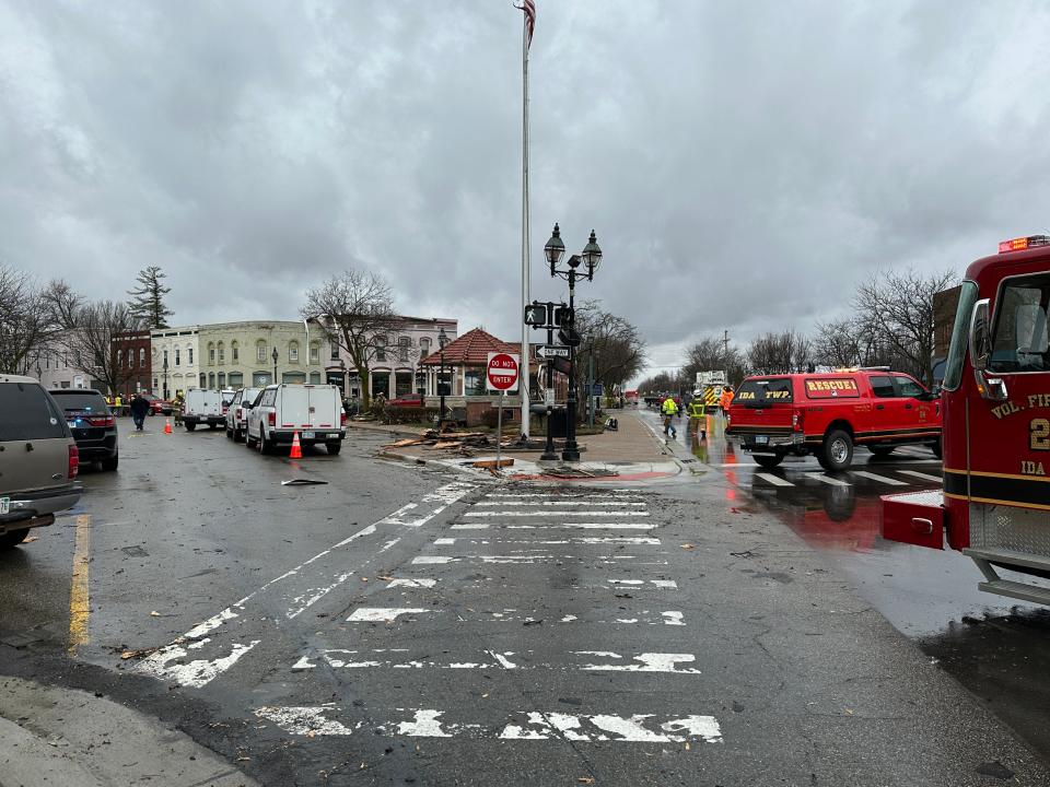
"The tornado then tracked along Brewer Rd with damage consisting of sporadic downed large limbs as Brewer Rd turned into Riley St. upon entering into the village of Dundee," the release said. "Estimated wind speeds increased to a peak of 80 mph in downtown Dundee...specifically in the immediate vicinity of Memorial Park...with increased wind speeds aided by funneling effects between downtown buildings. Damage in this area consisted of a roof being partially blown off, windows blown out, downed limbs, and nearby car damage. The tornado then tracked further east northeastward until ending near the intersection of Dixon Rd and Sullivan Rd with continued sporadic downed large limbs."
The tornado's path was measured at 75 yards wide, the weather service said.
EF0 tornadoes have winds of 65-85 mph. For comparison, the tornado that hit Dundee in 2010 started out as a high-end EF2 tornado with 130-135 mph winds when it touched down in the area of M-50 and North County Line Highway, according to a weather service report. When the 2010 twister reached Dundee, the maximum winds were 115 mph, which is at the low end of the EF2 range.
The most violent tornadoes are classified as EF5 with maximum winds of more than 200 mph.
Emergency personnel closed streets going into the downtown Dundee area Saturday morning while firefighters and building inspectors checked the structural integrity of the damaged buildings. M-50 was reopened as of 6:30 p.m., the Dundee Police Department said Saturday evening in a post on Facebook.
"Park Place and the adjacent sidewalk remain closed to vehicles and pedestrians, while (some) structural damage is still being assessed," the post said. "Any residents that were asked to leave, may now return to their apartment or dwelling."
"There does not appear to be any injuries," Dundee police said in a post Saturday morning on Facebook. "Everyone is urged to check on your family, friends and neighbors."
Dundee police and firefighters were on the scene immediately, the police's Facebook post said. They were joined by Dundee Department of Public Works crews, Michigan State Police, Monroe County sheriff's deputies, firefighters from Ida and Summerfield townships, Monroe County Emergency Management, Michigan Gas Utilities and DTE Energy to assess the damage.
"Onlookers are asked to stay away and let assessment and clean up continue," the post said.
Bricks and other building materials blown off downtown buildings littered sidewalks and Memorial Park. Some vehicles parked on the street were damaged by falling debris.

The National Weather Service issued a severe thunderstorm warning at 10:51 a.m. for Monroe County and eastern Lenawee County. Radar showed the storm near Blissfield and moving northeast at 55 mph with 60-mph wind gusts. The warning said to expect damage to roofs, siding and trees.
Severe Thunderstorm Warning including Adrian MI, Monroe MI and Dundee MI until 11:30 AM EDT pic.twitter.com/c173Iee3Bf
— NWS Detroit (@NWSDetroit) April 1, 2023
DTE Energy's online outage map showed outages in northern and western Monroe County, including downtown Dundee, as well as a widespread outage in the area of U.S. 23 and Ida Center Road. Consumers Energy's online outage map showed a widespread power outage early Saturday afternoon southeast of Blissfield as well as scattered outages in southern Monroe County, in the Irish Hills and south of Hudson.
Saturday's severe thunderstorm followed storms that moved through the area Friday night.
This article originally appeared on The Daily Telegram: UPDATE: National Weather Service confirms tornado hit Dundee April 1

