Saturday snowstorm to dump foot of snow or more in Seacoast, southern Maine: What to expect
A winter storm moving toward the Seacoast is expected to bring the highest snowfall amounts of the winter season beginning late Friday night and into the weekend.
Beginning close to midnight Friday, the region could see snow accumulate 1 inch per hour until sunrise, with snow lasting through Saturday before tapering off mid-afternoon, per projections from the National Weather Service’s office in Gray, Maine.
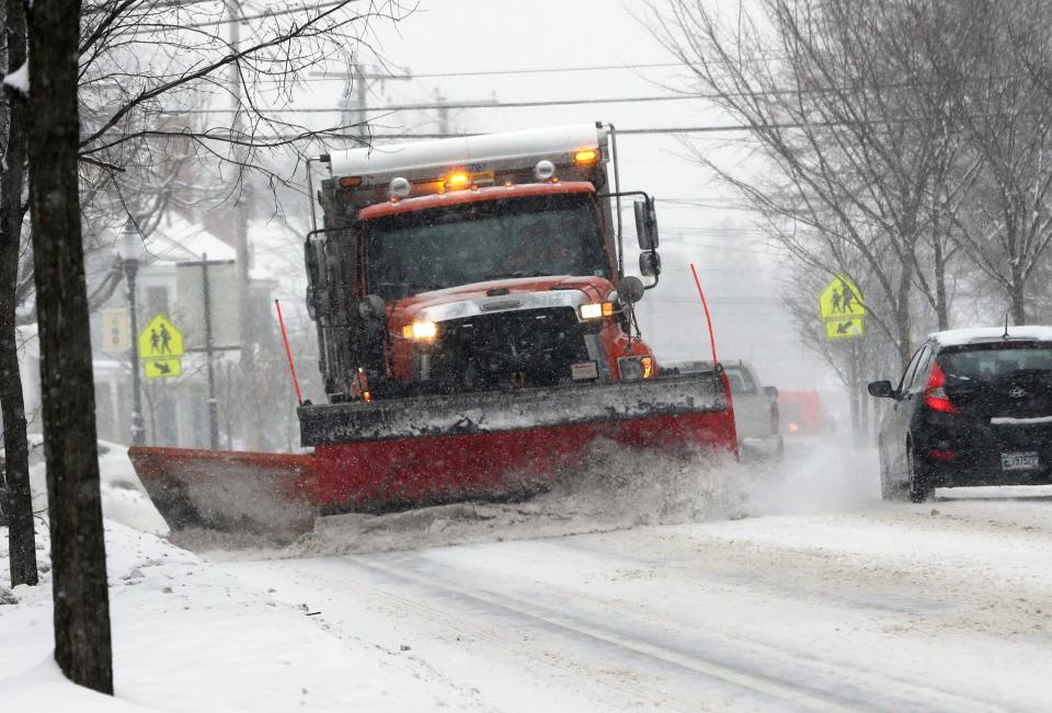
Meteorologist Chris Legro said Friday afternoon that towns along beaches in New Hampshire and Maine could receive 4-7 inches of snow. In Portsmouth and communities along Interstate 95, between 8-12 inches, while Strafford County and interior York County may get more than a foot, possibly 15 inches of snow.
Throughout the Seacoast, Legro noted that a possibility exists for sleet and rain to mix into the forecast Saturday morning before reverting to snowfall as the day progresses.
“It’ll be less of a mix and that heavier snow will linger longer,” he said of precipitation slated to come to Strafford County and York County.
More:Portsmouth Gas Light, Liquor Commission in settlement talks after fatal Thanksgiving crash
Snow is expected to wane throughout the region Saturday afternoon, likely by 4 p.m., with the highest amounts of accumulation anticipated to occur during the early morning before sunrise.
“Based on our forecast right now, especially in the Seacoast and into southeastern New Hampshire, it’s the biggest storm that we’ve had so far this year,” Legro added.
Winds on Saturday could gust upwards of 40 to 45 miles per hour along the immediate coastline of the two states, while both interior Strafford County and York County could be pelted with gusts above 30 miles per hour.
Seacoast temperatures on Sunday are expected to rise back to the low 40s after Saturday’s storm.
“It should be pretty good weather for storm cleanup,” said Legro.
Cities across the region have announced parking bans will begin on Friday evening, while Kittery, which has enacted its winter-long parking ban, noted that the town’s library and dump, along with the Kittery Community Center, will be closed on Saturday.
‘Wicked Tuna’:Seabrook woman reels in monster catch in TV debut- ‘It was awesome’
Unitil, Central Maine Power prepare for storm
In advance of potential power outages, Unitil Corporation has secured additional crews to aid with possible restoration efforts, and the electricity supplier is opening its Emergency Operations Center on Saturday at 6 a.m.
“We’ve seen a very active weather pattern in recent days with several systems impacting our area, but it appears this storm will be the most significant in terms of snowfall amounts,” said Unitil spokesperson Alec O’Meara. “The consistency of the snow is always critical and sometimes just a degree or two can make all the difference between a drier snow and one that’s wetter, heavier and more problematic.”
Central Maine Power spokesperson Jon Breed stated that the company will be pre-staging additional line and vegetation management crews in its service territory starting Friday night.
“During weather events like these, it is not uncommon to see power outages caused by vehicle accidents involving our electric poles," said Breed. "We urge all Mainers to use caution if driving on Saturday.”
The Front Porch in Ogunquit:New kitchen, rooftop bar with ocean views, and more planned
NH officials urge drivers to stay off roads during storm
The New Hampshire Department of Safety’s Division of Homeland Security and Emergency Management (HSEM) urges residents and visitors to use caution and avoid traveling if possible.
“Before the snow arrives Friday evening, take some time to prepare yourself and your family,” said HSEM Director Robert Buxton. “Stay informed by listening to local weather reports and signing up for NH Alerts and make sure all members of your family know your family emergency plan.”
Buxton offered these additional winter weather reminders:
Visit ReadyNH.gov to learn more preparedness tips to help you and your family stay safe, including information on making a family emergency plan and building an emergency kit.
Slow down and move over for emergency vehicles.
Clear all snow and ice off your car, including your roof, around lights, and license plates before traveling.Bridges, overpasses, and exposed road areas are the most prone to slippery conditions.
Find the latest road conditions at newengland511.org.
Plan two ways out of your home in case of an emergency.
Clear the driveway and front walk from ice and snow. This will provide easy access to your home.
This article originally appeared on Portsmouth Herald: Saturday snowstorm forecast to dump foot of snow or more on Seacoast

