Before-And-After Satellite Photos Show Harvey's Wrath

The numbers prove that Harvey was a monstrous storm.

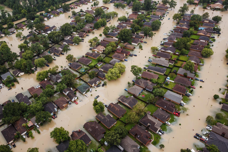
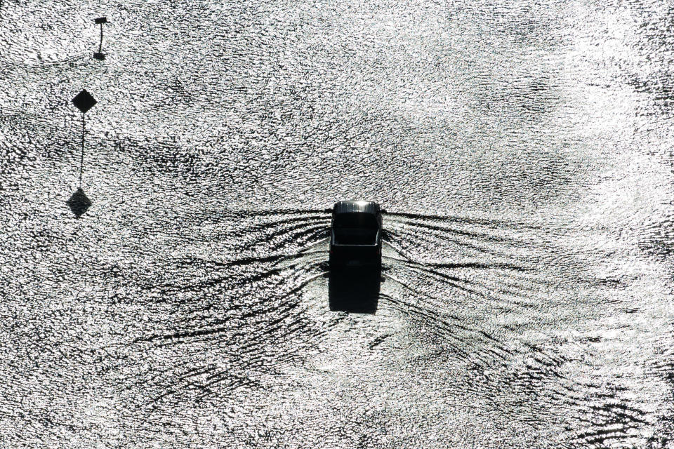
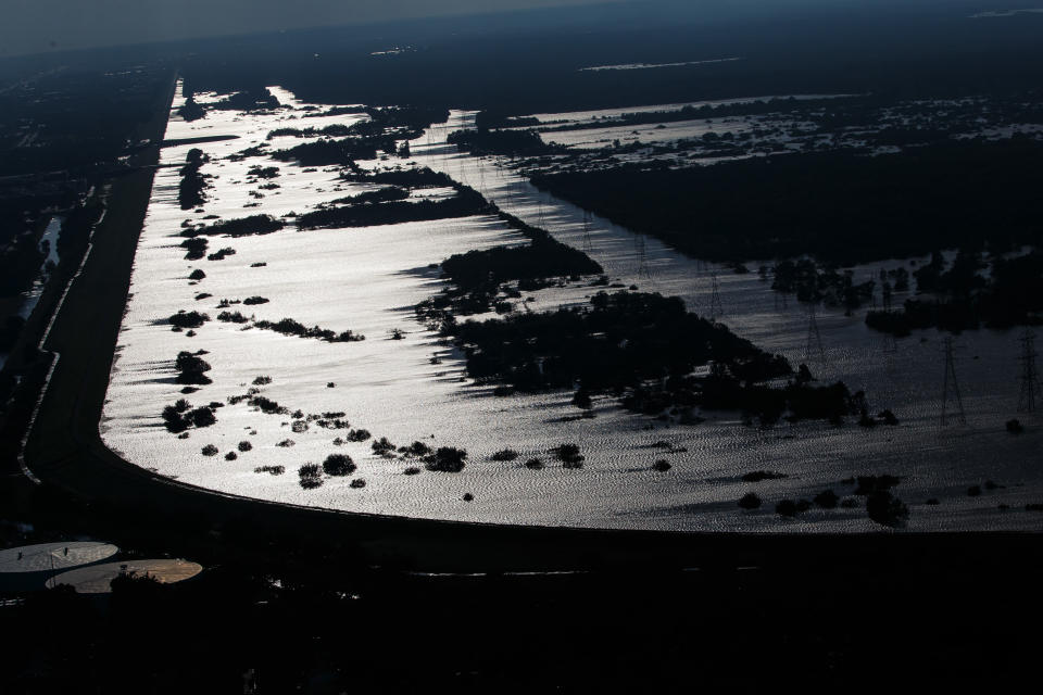
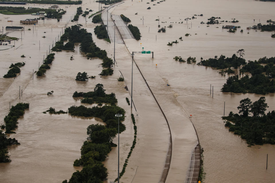
Harvey dumped an estimated 27 trillion gallons — that’s a “T” — of rain over Texas and Louisiana in a six-day period, with some locations seeing more than 4 feet. An estimated 100,000 homes have been damaged and at least 34,000 people are currently in shelters. Researchers have calculated it to be a 1-in-1,000-years flood event.

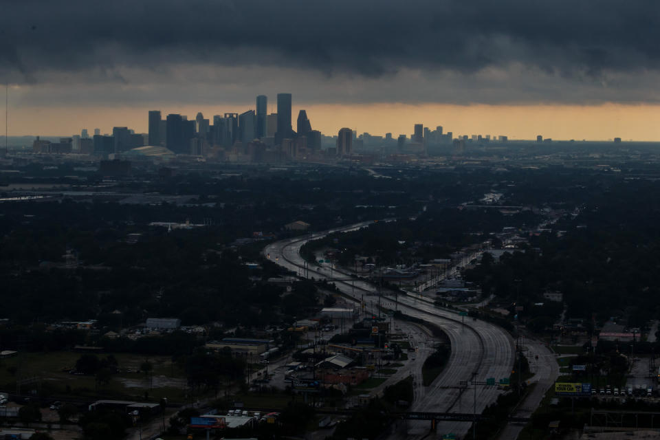
Photos of the catastrophic storm have gripped the nation.

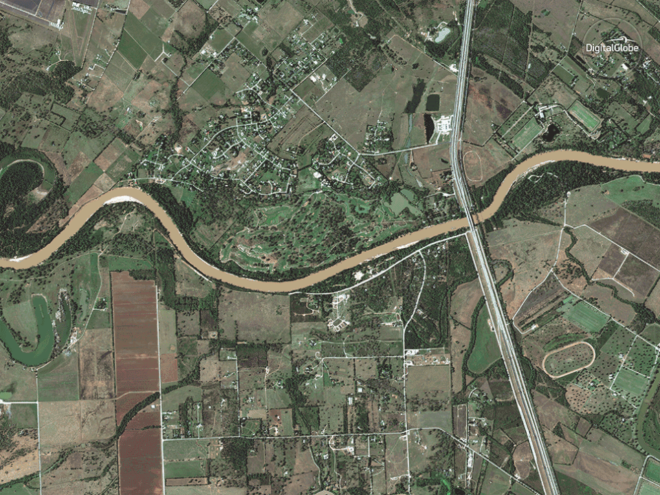
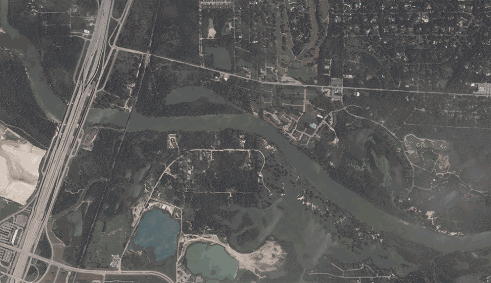
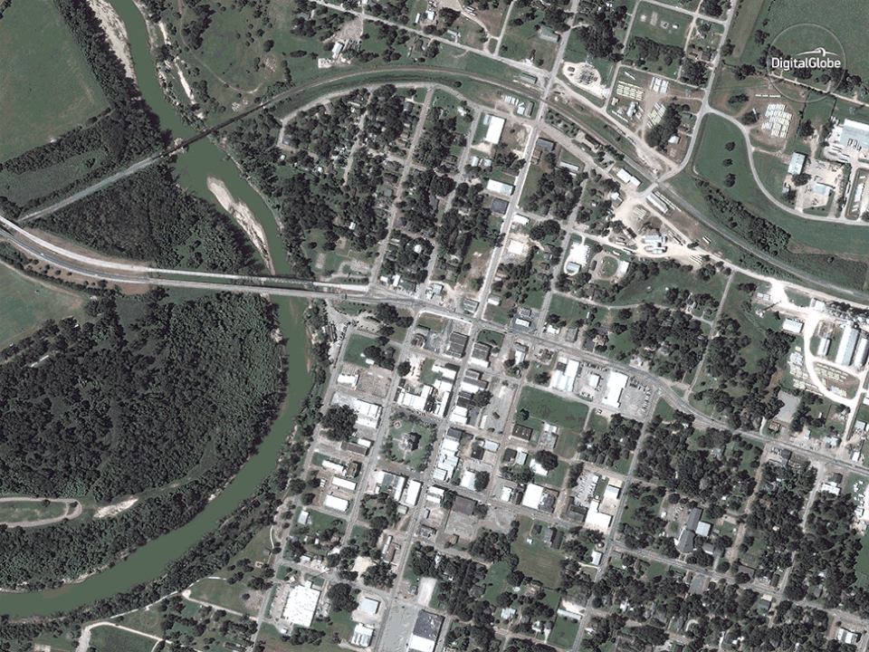
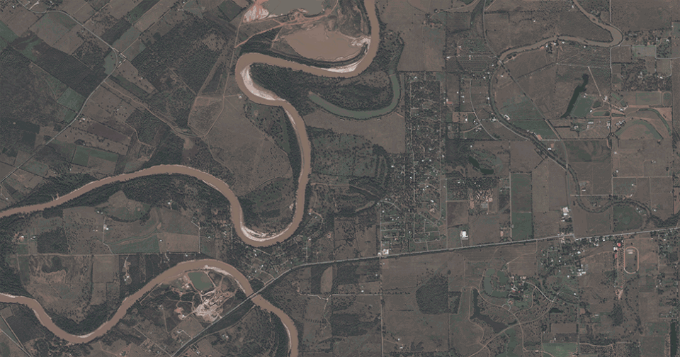
DigitalGlobe — a private space imagery company — on Thursday released a collection of jaw-dropping before-and-after satellite images that show the monumental scale of the flooding in Houston and the surrounding areas.

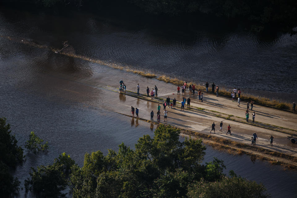
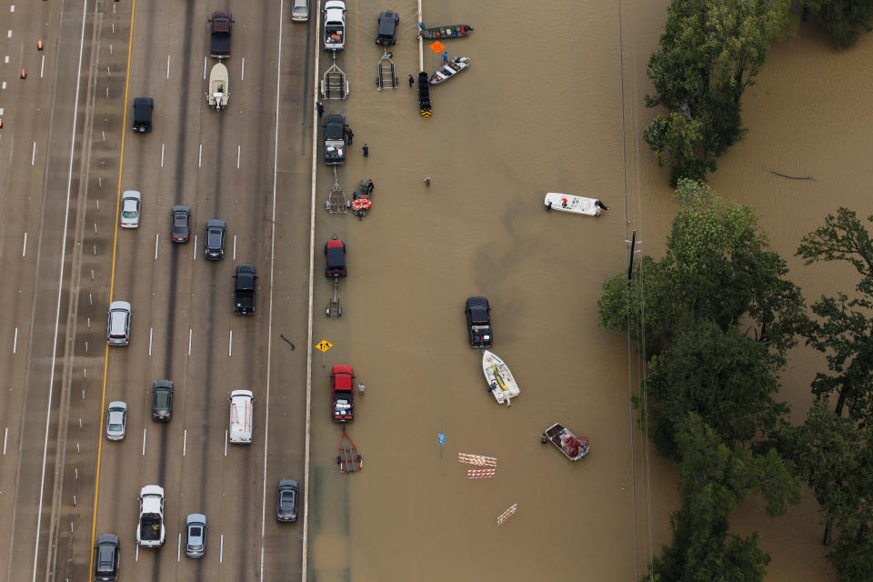
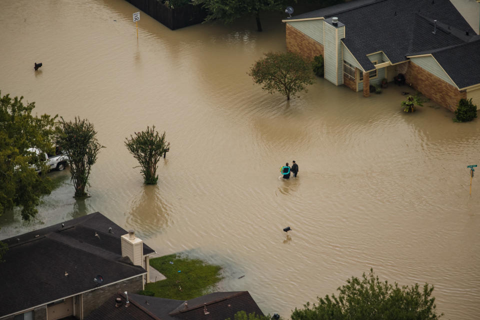
Below, a look at several inundated Texas towns.

Brookshire flooding
Brookshire flooding
Rosenberg flooding
Rosenberg flooding
Satellite imagery of the San Jacinto River basin following Hurricane Harvey
Angleton flooding
Angleton flooding
Wharton flooding
Wharton flooding
Holiday Lakes flooding
Beaumont flooding
Beaumont flooding
Simonton flooding
Simonton flooding
Houston flooding
Houston flooding
Simonton flooding
Simonton flooding

Also on HuffPost

Submerged Houston neighborhoods near Interstate 10 in the wake of Tropical Storm Harvey on Aug. 29, 2017.
Recreational vehicles lie on their sides in the floodwaters.
People survey the flooded areas near their homes.
Vehicles sit on a flooded portion of Interstate 10.
People walk through flooded neighborhoods.
A truck navigates through floodwaters in a residential neighborhood west of Houston.
The water levels are high at the Addicks Reservoir.
Portions of Interstate 10 are completely underwater.
An aerial view of downtown Houston under dark clouds.

Love HuffPost? Become a founding member of HuffPost Plus today.

This article originally appeared on HuffPost.