Residents give mixed reviews for trail options from Potato Creek to North Liberty
When you’re North Liberty townies like Donna Litteral and her husband — well, living just to the north in the country — how can you pass up a bike ride of a few miles to Potato Creek State Park?
Thing is, you've got to pay a certain price. It means cycling along Indiana 4, known for 55 mph or more traffic where, Litteral says, “Nobody cuts you any slack.”
“You have no other option,” she laments. “You go as fast as you can go, so you can get off (the highway) as fast as you can.”
The couple comes south via Sycamore Road and then, almost as bad as the highway, she says, on Redwood Road.
It hasn’t stopped her from logging about 2,000 bike miles in two years. But it points to why town officials, some local residents and bike advocates are serious about pursuing a paved trail of three to four miles between the town and Potato Creek — and have been for several years. And the reality that the state could break ground late this fall on a long-pursued inn at Potato Creek adds more motivation and, yes, potentially more trail users.
July 5, 2023: Half of Kal-Haven Trail to close. Path in Portage opens. And e-bikes in national parks?
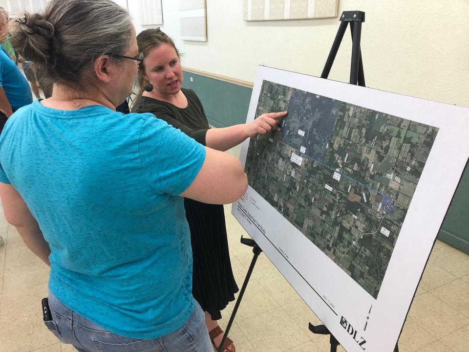
Litteral and more than 125 people packed the town’s community center on July 11 for an open house to look at maps and give feedback on two proposed options for the trail. Civic planners with the Michiana Area Coalition of Governments and with the county were seeking consensus so they can define a single route, then seek grant funding.
But, with more than 100 written comments in hand, there didn’t seem to be a single, clear answer. A lot of local residents came to the open house, especially those whose properties would be affected, along with biking advocates.

One option would follow an abandoned railroad route, and the other would follow a drainage ditch to the northeast of town. Both would inevitably connect with Indiana 4, where the trail would go along the north side of the highway until it reaches the park entrance. The railroad option would intersect earlier and mean following a longer stretch of Indiana 4. These two are narrowed down from at least five original options. Find a map attached to this story online.
Residents’ perspectives
Local resident Beth Albright (no relation to the bike shop owners) says she rides her hybrid bike on paved routes but, with a trail option skimming along her property, she says, “I just don’t want it in my back yard.”
“My concern is privacy,” she says, feeling that a popular trail could bring a lot of traffic.
Rachel Hatt says she has a shooting range in her back yard pointed to where the railroad option would pass, adding, “There’s a backstop, but there are stray bullets.”
She sees it as a safety issue for trail users but also for her and her private space, explaining, “I don’t want people from out of town going in my back yard.”
To be fair, trails in our area typically don’t have issues with cyclists or hikers wandering into private yards. It’s a common worry before a trail is built. Then, in many cases, property owners have built little bridges at the back of their lots so they can access the trail, too.
The ditch route would shave off a bit of the northern edge of Jeff Foster’s rural property while the railroad route would run through the southern edge along his front yard. He, too, shoots firearms against a backstop pointed toward the ditch trail option. That’s also where he and his wife have planted trees and placed beehives where deer visit — their “sanctuary.” His main concern is preserving the land’s habitat and serenity. He’s against both options but isn’t against having a trail.
Karen Rozycki retired as an accounts clerk for Potato Creek 13 years ago. Based on her 24 years there, she doesn’t think park visitors would like riding along Indiana 4.
“The customers come to the park for nature,” she says. “Any other route would be good.”
Some years ago, there was an option to continue following the railroad route south of the park, then find a way to cut north to the entrance, which would have apparently avoided much of the highway portion. But that trail would have bisected the farm fields of Tom L. McCormick. So, he says, he got an attorney to help push back and nix that option in 2017.
Caitlin Stevens, MACOG’s transportation director, says there may have been other concerns that stopped that option, too.
McCormick would still like to see an option that keeps the trail off of the highway.
His son, Tom E. McCormick, says the railroad option would shave a ribbon of land from two sides of his 12.5 acres of farm fields. But, as a member of the town’s fire department, he says his bigger concern is the safety of following the side of Sycamore as it crosses Indiana 4. He says there’s an incline coming along Sycamore, suggesting an extra challenge for trail users to make it across and beat the highway traffic. For that reason, he prefers the ditch option.
What protection would trail users have from Indiana 4 traffic that might veer off of the road?
On that section, Delores Stiffler, a local resident and president of the Friends of Potato Creek State Park, is concerned about little kids who might walk the path and wander off if parents aren’t watching closely.
Brian Smith, a civil engineer for the consulting firm DLZ, says that the Indiana Department of Transportation requires that the path be 28 to 30 feet from the highway, which is the distance in which most vehicles veer off of the road in accidents. That would place the trail beyond the line of wooden power poles. There could be guard rails in certain spots, but, he says, “You don’t want two miles of guard rails.”
Minimizing impact
For those who don’t live there, it’s more a matter of preference and scenery. Some suggest the ditch route might offer more time in natural areas. Bruce Wukovits of South Bend loves the railroad route simply because he loves everything about trains; so he’s a big fan of rail-trails like the Kal-Haven, Pumpkinvine, Panhandle Pathway and Nickel Plate trails.
In the end, MACOG’s Stevens says, planners emerged with a “mixed bag of comments” and a split over which option the public may prefer, though it seems most people aren’t opposed to the idea of a trail into the park. She says officials will study the comments and plan more discussions over the options.
June 14, 2023: Trails galore across St. Joe County, plus one in Benton Harbor: They grow to connect.
“Our main goal is to minimize impact to properties while still providing a route that’s safe,” she says.
Once a route is chosen, planners can then seek funding, either from Indiana Gov. Eric Holcomb’s Next Level Trails grant program (the next grant cycle’s deadline is in August) or from a variety of federal sources.
And once this trail is on its way, leaders want to extend the trail from the park east to Lakeville as well. There are three current route options for that so far.
North Liberty town trails
The town of North Liberty already has built about two miles of trails, tip to tail, that cut through town.
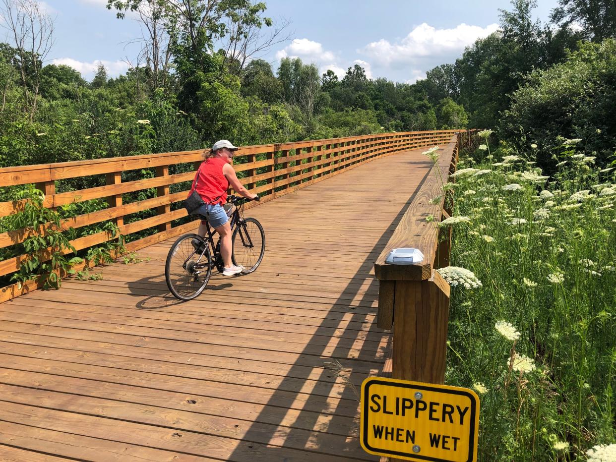
The community center at 300 S. Main St., serves as a good hub. From there, the 0.87-mile Stellar Trail crosses a long wooden boardwalk over a wetland, then comes along a private field with wildflowers.
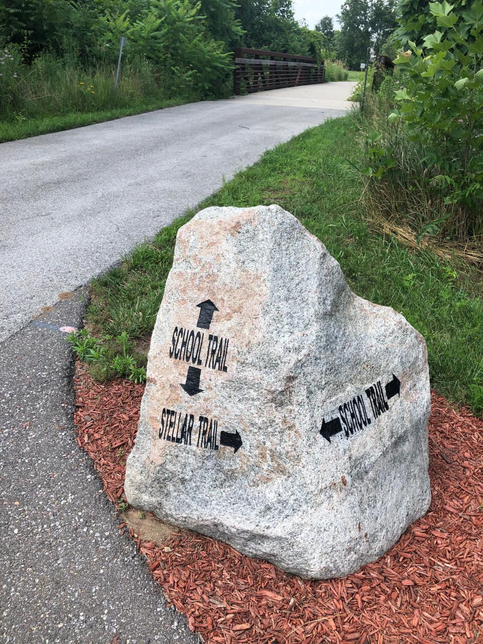
It intersects with the 0.22-mile School Trail, which runs to North Liberty Elementary School and crosses the stream Potato Creek.
Also from the community center, the 0.88-mile Tamarack Trail goes south through a tunnel of trees and reaches ball fields by a VFW post at the south end of town.
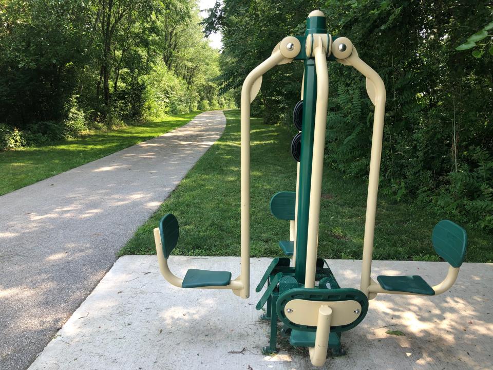
There are exercise stations spread out along the trails, plus some benches and a water station at the community center. The trail names are marked on big rocks.
Find columnist Joseph Dits on Facebook at SBTOutdoorAdventures or 574-235-6158 or jdits@sbtinfo.com.
This article originally appeared on South Bend Tribune: Potato Creek park trail to North Liberty gets mixed reviews residents

