'Miserable': A sweltering, sticky and stormy week ahead. Here's what to know.
The weather in Louisville will start out miserably hot and humid and likely develop into scattered thunderstorms by the end of the week.
According to the latest data from the National Weather Service, the heat index for Tuesday will feel like 107 degrees with the summer heat and high humidity.
It will continue into Wednesday, where NWS Louisville meteorologist Kyle Wilkins predicts it will be in the upper 90s and feel like 105-110 degrees with the humidity.
"The pick of the week for feeling miserable is Wednesday," Wilkins said.
By Thursday, it will get slightly cooler, he said, but the heat index will still be close to 100 degrees.
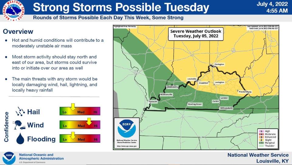
These hot and humid temperatures lead to unstable air masses, which can create storms.
"Any time it's hot, we are generally really unstable," Wilkins explained. "This time of the year the instability is high."
If the precipitation occurs, the worst will likely be at the end of the week and more towards the northeast, perhaps around Cincinnati, Wilkins said. However, there is a chance of thunderstorms in Louisville, too.
In this case, Wilkins said to expect lightning and gusty winds.
However, he said it is likely these storms will be localized.
"You could be a mile away and not have any storms," Wilkins said. "The vast majority of people aren't going to see anything."
Stormy weather ahead in forecast
Air masses moving from the northwest move into the region could bring occassional bouts of wet weather through Louisville this week.
"There will likely be isolated scattered thunderstorms through Thursday," Wilkins said Tuesday morning.
A heat advisory will be in place for much of the week as temperatures increase – the weather service put one in place at noon Tuesday. Slightly cooler temperatures are expected as we get closer to the weekend, Wilkins said, but storms could be in the forecast at that point as well.
"Friday's cold front will move across the area which will trigger some activity," he said.
Damaging winds or hail are possible, accompanied by heavy rainfall and lightning. It's advised to use caution, travel safely and keep your umbrella handy.
Louisville traffic: Section of Interstate 65 to be closed for more than a month in downtown Louisville
Coming Louisville forecast
Monday: Sunny and hot, with a high near 94 degrees.
Monday night: Partly cloudy, with a low around 77. Light south wind.
Tuesday: A 40% chance of showers and thunderstorms, mainly after 2 p.m. Mostly sunny and hot, with a high near 97. Heat index values as high as 105. Southwest wind 5 to 9 mph.
Tuesday night: A 40% chance of showers and thunderstorms. Partly cloudy, with a low around 76. Southwest wind 3 to 7 mph.
Wednesday: A 50% chance of showers and thunderstorms, mainly after 2 p.m. Mostly sunny and hot, with a high near 96 degrees.
Thursday: A 50% chance of showers and thunderstorms, mainly after 8 a.m. Partly sunny and hot, with a high near 95 degrees.
Friday: A chance of showers and thunderstorms, then showers likely and possibly a thunderstorm after 2 p.m. Partly sunny, with a high near 92. There is a 60% chance of precipitation.
Saturday: A 40% chance of showers and thunderstorms. Mostly sunny, with a high near 89.
Sunday: Sunny, with a high near 87.
This article originally appeared on Louisville Courier Journal: Louisville weather: City to have a sweltering, sticky and stormy week

