'A wintery mess': Major snow to hit Oregon passes, Eugene snow likely over weekend
Snow in the Willamette Valley appears increasingly likely the day after Christmas and travel is expected to be challenging all around the holiday as snowy weather moves into Oregon and across the Pacific Northwest.
Snow this weekend looks likelier in Eugene than further north in Salem or Portland, according to National Weather Service meteorologist John Bumgardner said, noting it's likely to be a "wintery mess."
"The temperature is going to be fluctuating a lot," he said. "We may transition from snow Sunday morning to some rain or all rain Sunday afternoon, and then back to snow that night."
There's a 95% chance of there being at least an inch of snow and a 67% chance to accumulate 4 or more inches in Eugene by Monday, he said. The snow level is expected to drop from 1,000 feet to 600 feet after midnight Sunday.
To the north in Portland there's a 75% chance of at least an inch of snow by 4 a.m. Monday morning, and a 65% chance in Salem.
Nothing about the weather is written in stone, of course, and projecting low-elevation snow in western Oregon is difficult because of the mixture of warmer ocean precipitation and cold air from the north.
Normalcy (kind of): Oregon's ski areas return to normal but keep pandemic strategies to tame overcrowding
Colder temperatures and snow likely this weekend into next week. Confidence low in forecast details, especially snowfall. Got travel plans? Be ready for wintry weather, and always check for the latest forecasts. #orwx #wawx pic.twitter.com/TdMOFW4CDB
— NWS Portland (@NWSPortland) December 22, 2021
Landslides: Highway 126 West reopened after landslide near Florence, new landslide delaying Highway 101
In other words, the forecast is likely to change. But given the high travel volume and potential snow, weather officials are warning travelers well in advance to be prepared.
Into next week, the weather is expected to stay cold enough for more valley snow but whether any precipitation arrives is still unclear.
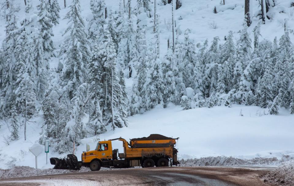
Mountain road travel could become hazardous
Travelers over Oregon's Cascade Range passes will see heavy snow Wednesday night, with more expected Thursday and Friday.
A winter storm watch for Wednesday into Thursday projects 8 to 24 inches above 4,000 feet, with the heaviest accumulations above 5,000 feet. The heaviest snow doesn't arrive until Wednesday evening.
The highways most likely to be impacted include Highway 58 over Willamette Pass and Highway 22/20 over Santiam Pass. Travel conditions are expected to be difficult, with snow and ice covering the roads and reduced visibility.
The snow levels drops lower Friday and will impact a larger swath of roads.
"Friday is looking like the snowiest time and toughest to travel pre-Christmas, because it's also expected to impact lower roads, with the snow level possibly dropping down to 2,000 feet," said Daniel Hartsock, meteorologist with the National Weather Service in Portland.
The heaviest snow appears centered on the northern half of Oregon's mountains, with somewhat less in the state's southern half.
In general, travel over mountain passes could be snowy from Wednesday through the weekend and into next week on highways including:
I-5 in Southern Oregon into California
Highway 58 between Eugene and Central Oregon
Highway 22/20 on Santiam Pass between Salem and Bend
Highway 138 east of Roseburg and Highway 140 between Medford and Klamath Falls
However, snow could also fall on Coast Range highways between the Willamette Valley and Oregon Coast, although in Lane County's Coast Range it's more likely to be rain with some snow showers.
Snowy conditions in Washington, California as well
Similar snowy conditions are projected in Washington and California as well, for those traveling out of state. Follow NWS Medford or NWS Seattle for conditions in southern Oregon and northern California, and northwest Washington.
Power companies prepare for outages
Power companies are preparing for potential outages with the possibility for valley snow. The good news, Hartsock said, is that not much ice is expected with the weather system, meaning a replay of winter storms from 2016 and 2019 and widespread outages is unlikely.
Even so, they'll have teams in the field over the holidays.
"We are actively monitoring the weather and will have additional crews on standby in order to respond to any outages as quickly as safety allows if/when conditions warrant," PGE spokesman Jonathan Hutchison said.
How to travel safely
The best place to find up-to-date information on weather is the Portland National Weather Services' Facebook and Twitter page, along with the page that shows detailed forecasts at weather.gov/pqr/.
Check out road conditions in advance and get real-time road reports at tripcheck.com.
Good equipment for vehicles include snow tires or chains and emergency supplies including:
Extra gas
Blankets
Shovel
Water (one gallon per person per day for several days, for drinking and sanitation).
Food (at least a three-day supply of non-perishable food)
Battery-powered or hand-crank radio and a NOAA Weather Radio with tone alert
Flashlight
First aid kit
Extra batteries
Whistle (to signal for help)
Moist towelettes, garbage bags and plastic ties (for personal sanitation)
Wrench or pliers (to turn off utilities)
Manual can opener (for food)
Local maps
Cell phone with chargers and a backup battery
Zach Urness can be reached at zurness@statesmanjournal.com or 503-399-6801. Find him on Twitter at @ZachsORoutdoors.
This article originally appeared on Salem Statesman Journal: Major snow to hit Oregon mountain passes, Eugene snow likely

