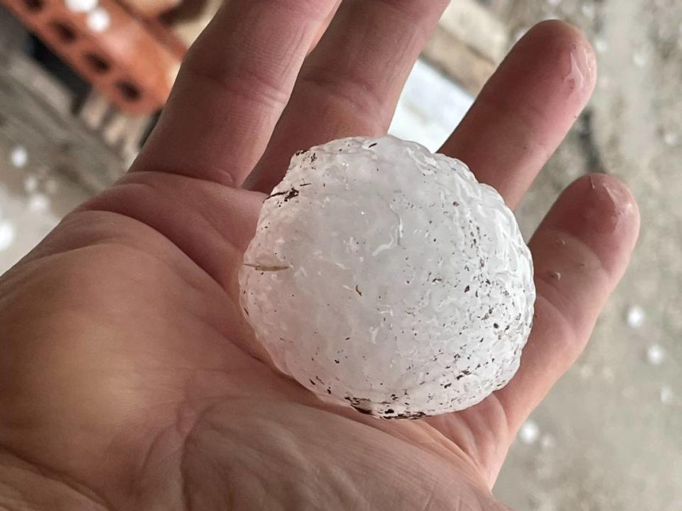
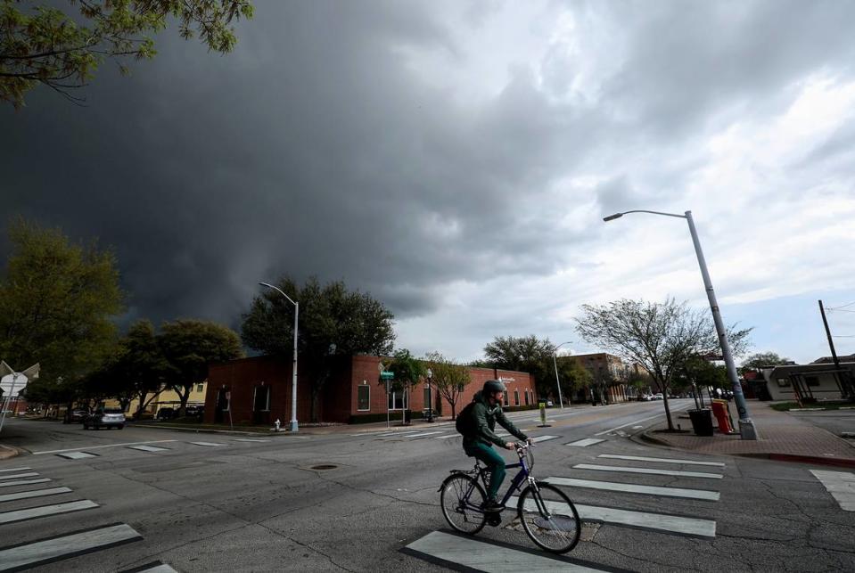
Tornado watch expires in Dallas-Fort Worth; tennis ball-size hail reported
A tornado watch that was in effect for the Dallas-Fort Worth area until 8 p.m. Thursday expired after severe storms brought large hail, strong winds and heavy rain to the region.
A tornado warning that was announced until 5 p.m. Thursday for parts of Tarrant County, including downtown Fort Worth, expired early but not before weather spotters confirmed seeing cloud rotation form at least briefly.
Another tornado warning that was in effect for Dallas County also expired. At 4:56, a severe thunderstorm capable of producing a tornado was located near Irving, moving northeast at 40 mph. Storm damage was reported at Autos of Dallas car dealership in Irving, where part of the roof was torn off but no one was injured. Roof damage to seven units at a townhome complex in Irving also was reported to the National Weather Service.
The roof was ripped off of Autos of Dallas in Irving today. More video of damage from today's storms here: https://t.co/ddVvYg7h6H pic.twitter.com/JLm0OoHRpN
— FOX 4 NEWS (@FOX4) March 16, 2023
The Fort Worth Office of Emergency Management said that no major reports of storm damage had been received as of about 6 p.m., when the worst of the storms were moving out of Tarrant County. On Twitter, the City of Fort Worth said that stormwater crews were responding to calls and alerts. The city reported road closures at 400 Long Ave. and NE 28th and Decatur. Crews were scouting the area of 121 and Riverside for potential storm damage.

Large hail up to the size of tennis balls has been reported across the region, and flooding also was reported in some areas, with the Fort Worth Fire Department being called to help people stranded in high water in areas including Camp Bowie Boulevard, Trinity Boulevard, Hulen Street, Vickery Boulevard, and Las Vegas Court, according to a call log.
The fire department said that when personnel arrived to the scene of high water calls, it was mostly people who had driven into floodwaters and gotten themselves out before would-be rescuers arrived. No injuries have been reported.
Between Between 4 and 8:30 p.m., MedStar ambulance crews responded to 13 motor vehicle crashes, including two rollovers. Five people involved in the crashes were transported to area hospitals.
The National Weather Service issued a flash flood warning for Tarrant and Dallas counties until 8:15 p.m. as heavy rain fell. The weather service noted social media reports of street flooding in downtown Fort Worth and reports of swift water rescues in North Richland Hills. Between 2 and 3 inches of rain had fallen as of about 5:30. Additional rainfall amounts of 1 to 2 inches were possible.
Fort Worth resident Isaac Cheek drove through what he thought was a tornado Thursday evening on his way back home from Coppell.
Cheek said he was driving on southwest Texas 121 at I-35 when he saw a funnel form in the distance soon after receiving a tornado warning.
“I tried to hurry up and get on the other side of it, and the wind caught me and sideswiped my car, about threw me into the wall,” he said.
#Storm damage in Grand Prairie
Roof blown off part of warehouse , blew to the other side. No injuries. #txwx #SevereWeather #dfwwx pic.twitter.com/IDXslyMdyB— Marc Gustafson (@newsgoose) March 17, 2023
I am hoping the driver of this semi is okay after wind did a number on his 18-Wheeler! Look at his windshield y’all. This is in the Walmart parking lot Westworth Village @wfaa @WestworthV @wfaaweather @JesseWFAA @fwfdincidents @FortWorthFire pic.twitter.com/0valdivfU3
— Scoop Jefferson (@scoopjefferson) March 16, 2023
A tornado warning was issued for Tarrant County on Thursday around 4:15 p.m. with the main area of concern around just north of where I-30 and I-35 meet. The warning was canceled about 30 minutes later.
A tornado warning means to take shelter in a basement or the interior room of the lowest floor of a building. The National Weather Service said the storm capable of producing a tornado, which triggered the Tarrant County warning, was over River Oaks when the sirens began sounding. It was moving toward Fort Worth and Arlington.
A tornado watch means that tornadoes are possible and people in the affected area should take extra precautions and watch the weather.
Weather watches and warnings
A live data feed from the National Weather Service containing official weather warnings, watches, and advisory statements. Tap warning areas for more details. Sources: NOAA, National Weather Service, NOAA GeoPlatform and Esri.
An enhanced risk of severe weather reached North Texas on Thursday afternoon and evening, according to the National Weather Service. Storms were expected to include wind gusts up to 70 mph and hail up to 2.5 inches — about the size of a tennis ball.

A photo tweeted Thursday around 2:45 p.m. showed large hail near Possum Kingdom Lake.
Possum Kingdom Lake @wfaaweather pic.twitter.com/zx7VZbs4jU
— Koby Rogers (@TTURDRDR1) March 16, 2023
More than 5,500 Oncor customers were without power in Dallas County and more than 2,800 in Tarrant as of about 7:30 p.m., according to Oncor.
Electric outages Dallas - Fort Worth vicinity
Here is Oncor's power outages map. Outage information is sent from Oncor to the outage map every 10 minutes. Source: stormcenter.oncor.com
An overcast sky was forecast for the whole day, and National Weather Service Meteorologist Matt Stalley said the first round of severe weather would reach the metroplex around 4 p.m., when the service correctly predicted some parts of Dallas-Fort Worth would start to see “very large hail” and other severe weather conditions.

Another line of storms was expected to follow the first sometime between 6 p.m. and 8 p.m. with a chance of severe weather, but after that passes severe weather should be done for the night.
Stalley said forecasts predicted some rain and possible thunder after the second line of storms moved out of the region, but nothing severe.
A tornado watch expired early for some counties on the west and north sides of DFW but remained in effect until 8 p.m. for Tarrant, Dallas, Collin, Delta, Ellis, Fannin, Hopkins, Hunt, Johnson, Kaufman, Lamar, Rains and Rockwall counties.
A tornado watch continued until 1 a.m. for Central Texas counties including Navarro, Van Zandt, Anderson, Falls, Freestone, Henderson, Leon, Limestone, Milam and Robertson.
Had some minor reports of wind damage (roof shingles and some damages, a pole down, and trampolines blown around). Hope no one suffered any major damages. We continue to drive the neighborhoods to look for issues. pic.twitter.com/Gf8nyFbI5J
— WSPD (@WSPDTX) March 16, 2023
We also responded to an occupied commercial truck that flipped over while occupied by two people during the earlier storm. Both occupants were not injured. Occurred in the Sam’s parking lot on S.H. 183 in town. Additional photo included of storm approaching taken by community… https://t.co/ll4nd8MXQZ pic.twitter.com/XGgjLWoOwd
— Christopher Cook (@cooktx) March 17, 2023
Storm Reports
This map contains continuously updated storm reports and damage from the National Weather Service for the past 48 hours. Reports include tornado, wind storm and hail storm reports. The map also includes tornado reports for the past week and recent rainfall accumulations. Sources: National Oceanic and Atmospheric Administration (NOAA), Esri.
The storms will usher in a cold front with nearly a week of highs in the 50s and lows in the 30s, though no freezing temps are in the forecast for the Fort Worth area.
Freezing temperatures will be possible during the upcoming weekend in areas north of the I-20 corridor. A late-season frost is likely Saturday morning in sheltered locations and where light winds dominate, the NWS said in a hazardous weather outlook.
3-Day Storm Outlook
This map shows the 3-day weather outlook for storms by the National Weather Service's Storm Prediction Center. Sources: National Weather Service, Esri.
Current Temperatures
Current temperatures and weather data from NOAA weather stations updated hourly. Tap on the map for current weather conditions, including humidity, wind speed. and direction. Data provided by NOAA and Esri.

