Google Maps Can Help You Check Your Neighborhood's Air Quality—Here's How to Use the Feature This Summer

MoMo Productions/Getty Images
Mother Nature is calling, beckoning everyone near and far to get outside (safely!) this summer. Thankfully, whether you're venturing to new places or spending an afternoon at home in your garden, you can now use the Google Maps app, which works across Android and iOS devices, to determine the air quality of your immediate locale. This will allow people to "make more informed decisions about whether it's safe to go on a hike or other outdoor adventures," a representative of the company told Mashable.
This feature is currently only available for users in the United States, and includes data from the Environmental Protection Agency, along with PurpleAir, which details hyper-local air quality information. These agencies track pollution in any given area with an air quality tool that calculates the Air Quality Index (AQI). That data is available right on the Google Maps app—which helps you and your family make choices about any outdoor activities you have on the books.
Related: The 10 Best Ways to Clean the Air in Your Home
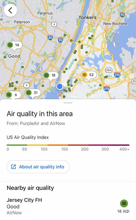
Google Maps
Want to track your neighborhood's air quality using Google Maps? Follow these steps:
Begin by launching Google Maps on your device.
Select the button in the bottom right area of your screen to mark your location. (You can also type in your location in the search bar.)
Press the layers button in the top right area of your screen (under the search bar) to pull up the menu.
Tap "Air Quality" in the map information.
Google Maps will show the index and feature the latest details on the air quality in your area.

