Freezing rain is forecast to affect travel near Dallas-Fort Worth. Here’s the timeline
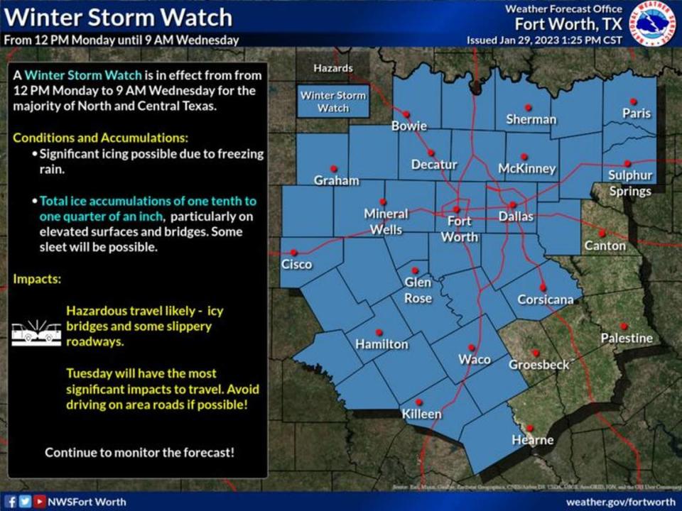
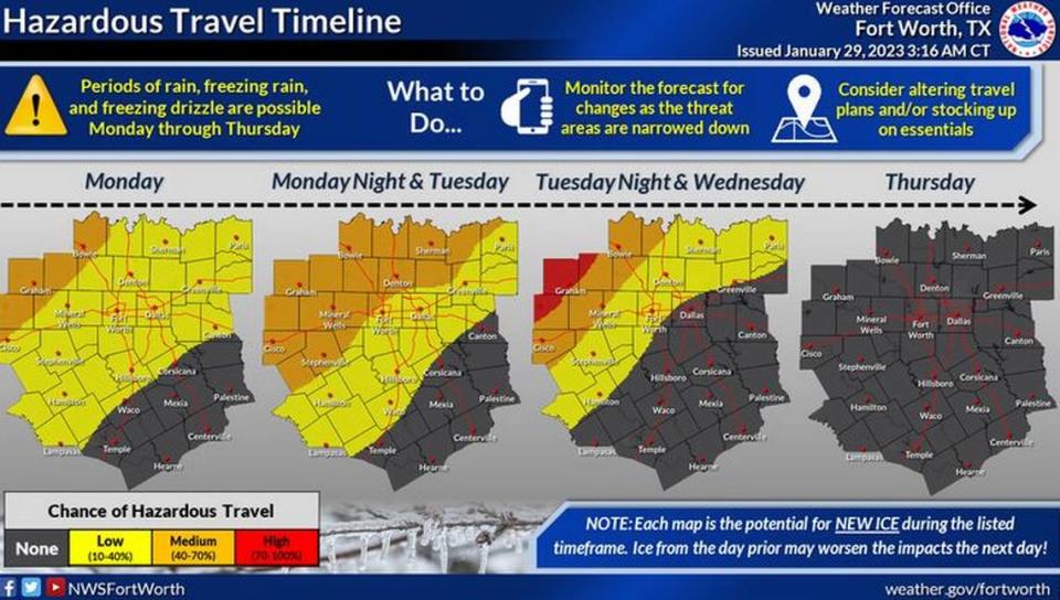
Freezing rain that could foil travel is forecast to fall during three days early this week, particularly north and west of Dallas-Fort Worth, according to the National Weather Service.
The most significant travel problems will occur on Tuesday. Total ice accumulations of a tenth to a quarter of an inch are forecast. Sleet is possible.
The weather service issued a winter storm watch for the region that will be in effect from Monday at noon to Wednesday at 9 a.m. The watch covers counties in most of North and Central Texas, including Tarrant and Dallas.
On Monday, there is a slight chance of freezing rain and sleet between 9 a.m. and noon. In the afternoon, there is a chance of rain, freezing rain and sleet. The high temperature will be near 32, the weather service said. The chance of precipitation is 40%.
On Monday night, there is a chance of rain or freezing rain before midnight. After, there is a chance of freezing rain. Skies will be cloudy and the low temperature about 30. The chance of precipitation is 40%.
On Tuesday, freezing rain is forecast to affect travel. The high will be near 34. The chance of precipitation is 80%.
Black ice may form on bridges and overpasses. Drivers were advised to slow down and plan additional time for travel.
Rain is expected on Wednesday and Thursday, when the high will climb to about 40.
Weather watches and warnings
A live data feed from the National Weather Service containing official weather warnings, watches, and advisory statements. Tap warning areas for more details. Sources: NOAA, National Weather Service, NOAA GeoPlatform and Esri.

