Wildfire destroys four structures, threatens 500 more in rural Northern California
At least four structures have been destroyed and more than 500 others are threatened by a growing wildfire in Northern California's rural Nevada County, fueled by a "critically dry" and "drought-stressed" environment, according to an update from from Cal Fire officials.
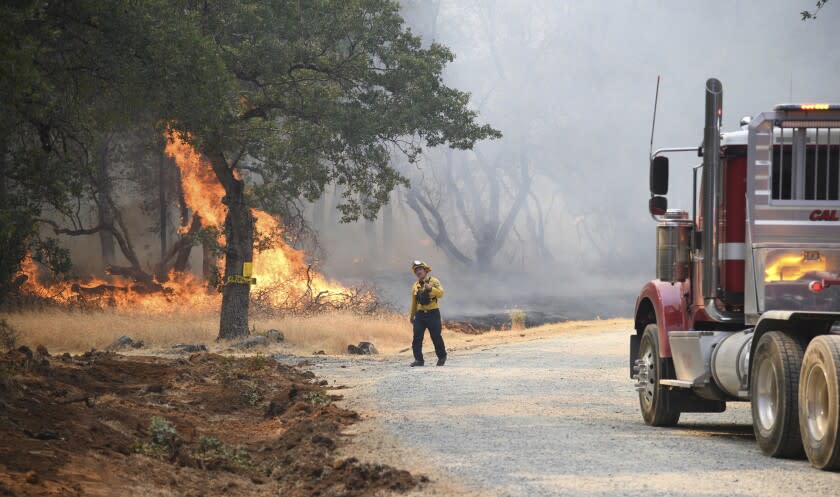
The fire has burned 769 acres as of 7 a.m. Wednesday, growing by almost 200 acres overnight, and is still 0% contained, the update said. Multiple residential communities in the area are under evacuation orders and warnings, as almost 650 firefighters battle the blaze.
At least one firefighter has been injured, according to the latest report, but details were not immediately available.
The Rices fire started around 2 p.m. Tuesday in the area of Rices Crossing Road, north of the south fork of the Yuba River and west of the community of North San Juan, said Brian Estes, unit chief of the California Department of Forestry and Fire Protection's Nevada-Yuba Placer Unit.
"Steep and rugged terrain, critically dry and receptive fuel beds, active area for fire history and drought-stressed trees are leading to the observed active fire behavior," the latest update said.
The cause of the blaze remains under investigation.
Residents initially tried to put out the fire, but when the first units arrived about 10 minutes after authorities received a report, it was being driven by the dry, windy conditions, Estes said.

The fire was burning in brush, oak woodlands and heavy timber, moving to the north and northeast toward the Yuba River drainage, Estes said. Temperatures during the day were above 96 degrees, relative humidity was below 10% and winds of at least 8 mph were blowing out of the southwest.
Among the 500 structures threatened is critical infrastructure such as water delivery and Pacific Gas & Electric Co. electrical systems, Estes said. South Yuba River State Park was also threatened.
"Our main efforts in the suppression … of this fire now are to keep it from dropping into the Yuba River drainage," he said.
If the fire crosses the drainage into Yuba County, it could "have some tremendous impacts" to communities such as Dobbins and Oregon House, he said.
"We are one of the few, large dynamic incidents going on in the state, so the support that we've received … has been tremendous," Estes said.
Mandatory evacuation orders are in place for four zones, including the communities of Birchville, Sweetland, French Corral, Bridgeport, Rice's Crossing and the Buttermilk area, according to Cal Fire.
Adjacent zones to the north are under evacuation warnings, including North San Juan, Sebastopol, New School, Robinson, Greater Tyler Foote, northern Purdon Road, Millhouse, Montezuma and Central Purdon.
A detailed map of areas under evacuation orders and warnings is posted online.
A temporary evacuation point is open at the Madelyn Helling Library in Nevada City, according to the Nevada County Office of Emergency Services.
The Nevada County Fairgrounds in Grass Valley are receiving animals, the Sheriff's Office said.
Residents of neighboring Yuba County in areas north of Marysville Road, Troost Trail, Fairhaven Drive, Lake Francis Road, and south and east of Marysville Road were placed under an evacuation advisory and told to be on the alert for changing conditions, officials said.
This story originally appeared in Los Angeles Times.

