Google Maps releases update to make your commute less stressful

You know what’s worse than Monday? A Monday where you sit in traffic for an hour on your way to work. No one wants to crawl along behind a sea of other cars and trucks, or have their train stopped with no sense of when it will move again.
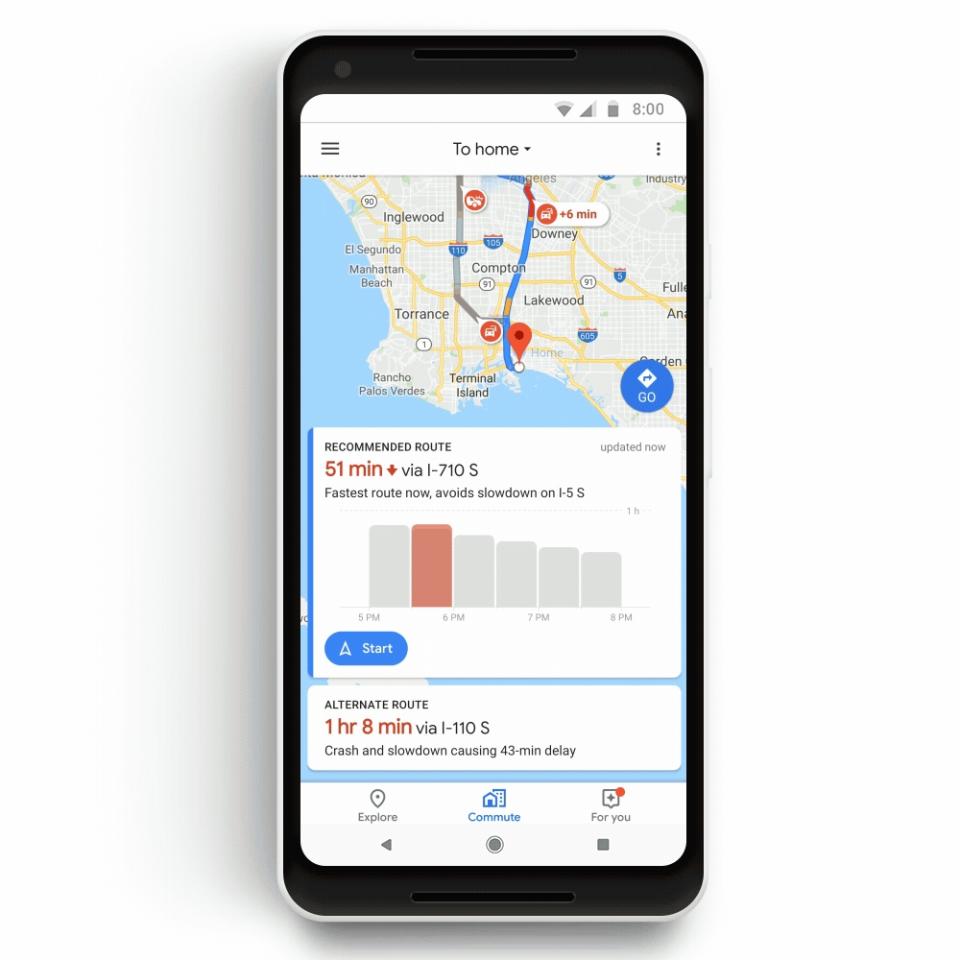
But that could soon change thanks to a new update for Google Maps. That’s because the navigation app is getting a Commute tab that will give you information about your route to and from work, including real-time traffic updates, alternate routes and more.
Google’s transit features are certainly welcome, but they’re not entirely new. New York City’s Metropolitan Transit Authority already offers real-time subway arrival times and the ability to track the exact location of your bus on its route via the MyMTA app.
Apple Maps, for its part, also gives you a view of subway stations’ footprints, and tells you what exit is best to use to get to your final destination.
Get me to work on time
With the Commute tab, Maps will give you information about your daily drive or ride including how long it will take based on the available route and time of day. Of course, you’ll also have to save your commute information in the app first via Commute settings in the app’s Settings menu.
Android users will also get notifications about traffic and slowdowns along their usual route, which means you won’t have to look it up on your own every morning.
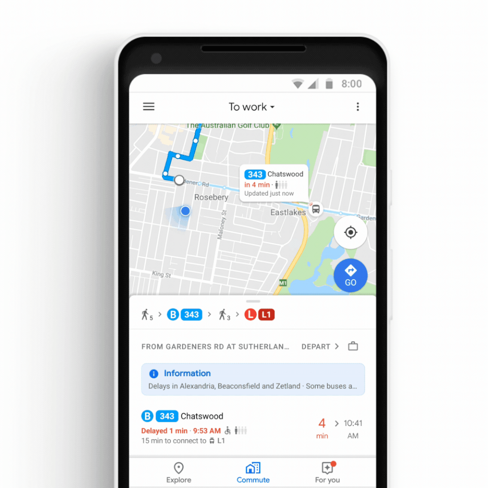
Better still, the update will bring real-time transit information to 80 cities around the world. Want to know which stop your bus or subway is at before you leave the house? No problem, Maps can do it. You’ll be able to open the app and immediately locate your bus or train.
Maps’ transit information for New South Wales will even include the number of people in a vehicle, so you’ll be able to see if you can fit on the next bus, or will have to wait for another. Google (GOOG, GOOGL) says that feature will be available in other cities soon.
On top of that, Maps will now support multimodal transportation. That means the app will tell you how long it will take you to get to work or home, and break the trip into the amount of time it will take to drive to the bus stop, how long the bus ride will take and how long it will take to walk from the bus stop to your office.
Maps does this for public transit directions already by telling you how long it will take to walk to the bus or train. However, it only tells you how long it takes by walking to the station, not if you drive there.
Blasting tunes behind the wheel
In what seems like an odd move, Google has also added Apple (AAPL) Music, Google Music and Spotify (SPOT) compatibility to Maps. This way you’ll be able to control your music from within Maps. I can’t tell you how many times I’ve been driving with my wife and we’ve changed the music in Spotify only to have to quickly switch back to Maps to make sure we didn’t miss a turn.
It’s a great idea, and ensures that you spend more time using Google Maps instead of jumping between others, which is sure to benefit Google.
The new version of Maps is rolling out globally this week.
More from Dan:
Facebook reveals 50 million accounts affected by security breach
Ex-Google engineer who worked on China search engine calls it ‘wrong’
Apple Watch Series 4 hands-on: Big screens, big improvements
Email Daniel Howley at dhowley@oath.com; follow him on Twitter at @DanielHowley. Follow Yahoo Finance on Facebook, Twitter, Instagram, and LinkedIn
